|
search place name
|
||
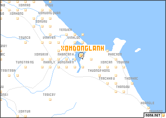
Xóm Ðộng Lành (Vietnam)Xóm Ðộng Lành is a town in Vietnam. An overview map of the region around Xóm Ðộng Lành is displayed below.
regional and 3d topo map of Xóm Ðộng Lành, Vietnam ::
Xóm Ðộng Lành airports ::
The nearest airport is ZVK - Savannakhet, located 239.0 km south west of Xóm Ðộng Lành.
Nearby towns ::
Dũ Lộc (1.9km south) //
Văn Yên (1.8km west) //
Hòa Luật (1.8km east) //
Hà Trung (1.9km north) //
Quyền Hoành (2.6km south west) //
Trung Hạ (2.6km north west) //
Ðồng Nại (2.6km north west) //
Nhân Canh (3.5km west) //
Hải Khẩu (3.7km north) //
Hưng Nhân (4.0km south west) //
Dụ Yến (4.0km south east) //
Văn Tràng (4.0km north west) //
Vĩnh Lộc (4.1km north west) //
Thượng Phong (5.1km south east) //
Kỳ Anh (5.3km west) //
Xóm Trang (5.6km north) //
Hậu Ninh (5.6km west) //
Giếng Vọt (5.6km west) //
Xóm Càn (5.6km east) //
Trường Lại (5.6km east) //
Ðồng Nghĩa (5.8km north) //
Ðan Du (5.6km west) //
Vĩnh Áng (5.6km east) //
Yên Ðiềm (6.6km north west) //
Thuận Ðịnh (6.6km north west) //
Sơn Luật (6.5km north west) //
Phác Môn (7.0km east) //
Biểu Duệ (7.0km west) //
Nhân Lý (7.3km west) //
[all distances 'as the bird flies' and approximate] 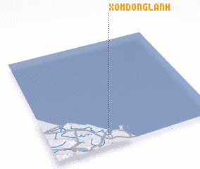 Places with similar names to Xóm Ðộng Lành, Vietnam :: Disclaimer :: Information on this page comes without warranty of any kind |
||
|
Where is Xóm Ðộng Lành? Elevation and coordinates ::
Latitude (lat): 18°5'0"N Longitude (lon): 106°21'0"E
Elevation (approx.): 132m (map arrows pan, magnifying glasses zoom) |
||
|
Visiting Xóm Ðộng Lành? Hotel/Accommodation ::
Book a hotel in Xóm Ðộng Lành Travel Guide ::
Buy a travel guide for Vietnam rental cars ::
car rental offers GPS waypoint ::
download a GPX waypoint (PoI) of Xóm Ðộng Lành for your GPS receiver
|
||