|
search place name
|
||
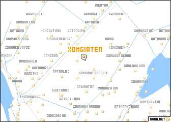
Xòm Già Ten (Kiến Giang, Vietnam)Xòm Già Ten is a town in the Kiến Giang region of Vietnam. An overview map of the region around Xòm Già Ten is displayed below.
regional and 3d topo map of Xòm Già Ten, Vietnam ::
Xòm Già Ten airports ::
The nearest airport is PNH - Phnom-penh Phnom Penh Intl, located 175.0 km north of Xòm Già Ten.
Other airports nearby include SGN - Ho Chi Minh City Tansonnhat Intl (177.3 km north east), Nearby towns ::
Xóm Xã Niệm (1.8km west) //
Xóm Bếp Bảy (2.6km south east) //
Ấp Ðông Phước (4.1km north west) //
Xóm Cỏ Khêu (4.1km south west) //
Xóm Kinh Tổng Bồi (1) (4.1km south east) //
Ấp Số Ba (5.2km north west) //
Ấp Hòa Bình (5.8km west) //
Ấp Tân Ðịnh (5.9km north) //
Ấp Kinh Bảy (5.9km north) //
Ấp Tân Lộc (6.1km south west) //
Ðá Nổi (6.6km north east) //
Dinh Ðiền Cái Sắn (6.6km north west) //
Ấp Ðịnh Tan (6.8km south) //
Xóm Ðùng Ðất Vân Tiên (7.0km south east) //
Ấp Kinh Tám (7.4km north) //
Ấp Hòa An (7.3km west) //
Xóm Ðường Chùa (7.3km east) //
Ấp Tân Sơn (7.6km north) //
Xóm Xẩu Chia (7.5km east) //
Ấp Thạnh Lộc (1) (7.5km east) //
Xóm Lẩm (7.5km east) //
Ấp Cò Tuất (8.3km south east) //
Xóm Bà Chuổi (8.6km south east) //
Giục Tượng (9.2km south west) //
Ấp Sóc Giũa (9.2km south west) //
Xóm Cây Tràm (9.2km north west) //
Ấp Thạnh An (2) (9.3km south east) //
[all distances 'as the bird flies' and approximate] 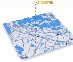 Places with similar names to Xòm Già Ten, Vietnam :: Disclaimer :: Information on this page comes without warranty of any kind |
||
|
Where is Xòm Già Ten? Elevation and coordinates ::
Latitude (lat): 10°1'0"N Longitude (lon): 105°15'0"E
Elevation (approx.): 2m (map arrows pan, magnifying glasses zoom) |
||
|
Visiting Xòm Già Ten? Hotel/Accommodation ::
Book a hotel in Xòm Già Ten Travel Guide ::
Buy a travel guide for Vietnam rental cars ::
car rental offers GPS waypoint ::
download a GPX waypoint (PoI) of Xòm Già Ten for your GPS receiver
|
||