|
search place name
|
||
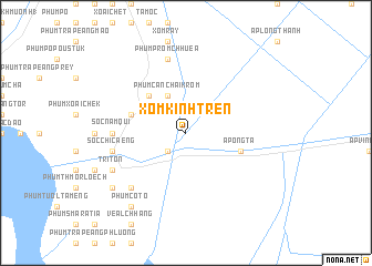
Xóm Kinh Trên (An Giang, Vietnam)Xóm Kinh Trên is a town in the An Giang region of Vietnam. An overview map of the region around Xóm Kinh Trên is displayed below.
regional and 3d topo map of Xóm Kinh Trên, Vietnam ::
Xóm Kinh Trên airports ::
The nearest airport is PNH - Phnom-penh Phnom Penh Intl, located 123.7 km north of Xóm Kinh Trên.
Other airports nearby include SGN - Ho Chi Minh City Tansonnhat Intl (178.2 km east), Nearby towns ::
Xóm Càu Sắc (2.6km south west) //
Phum Cần Chai Krom (4.1km north west) //
Phum Krang Chai (5.2km north west) //
Phum Banteai Dek (5.2km north west) //
Ấp Ông Tà (5.8km east) //
Sốc Cup Ðe (5.8km west) //
Sốc Sây Ðu (5.8km west) //
Sốc Nam Qui (7.3km west) //
Sốc Chi Ca Eng (7.5km west) //
Phum Prom Chhuéa (7.6km north) //
Phum Khvao (7.6km north) //
Phum Prolai Méas (7.6km north) //
Phum Chrouy (7.8km south west) //
Phum Krang Don (7.8km south west) //
Tri Tôn (8.2km south west) //
Phum Cô Tô (9.2km south west) //
Phum Talè (9.2km south west) //
[all distances 'as the bird flies' and approximate]  Places with similar names to Xóm Kinh Trên, Vietnam :: Disclaimer :: Information on this page comes without warranty of any kind |
||
|
Where is Xóm Kinh Trên? Elevation and coordinates ::
Latitude (lat): 10°27'0"N Longitude (lon): 105°4'0"E
Elevation (approx.): 4m (map arrows pan, magnifying glasses zoom) |
||
|
Visiting Xóm Kinh Trên? Hotel/Accommodation ::
Book a hotel in Xóm Kinh Trên Travel Guide ::
Buy a travel guide for Vietnam rental cars ::
car rental offers GPS waypoint ::
download a GPX waypoint (PoI) of Xóm Kinh Trên for your GPS receiver
|
||