|
search place name
|
||
Xóm Nhân (Vietnam)Xóm Nhân is a town in Vietnam. An overview map of the region around Xóm Nhân is displayed below.
regional and 3d topo map of Xóm Nhân, Vietnam ::

Xóm Nhân airports ::
The nearest airport is SNO - Sakon Nakhon, located 197.0 km south west of Xóm Nhân.
Other airports nearby include ZVK - Savannakhet (225.1 km south), Nearby towns ::
Bảo Thương (0.0km north) //
Trai Mó (1.9km north) //
Rạo Trạch (1.8km east) //
Làng Ha (2.6km north east) //
Tinh Diêm (4.0km north east) //
Trại Cúc (4.0km north east) //
Xóm Ðồng Hộ (4.0km south east) //
Xóm Lâm (4.0km south east) //
Tình Ði (5.3km east) //
Nam Nhé (5.3km west) //
Xóm Con Tội (5.3km east) //
Hà Tân (5.3km west) //
Phố Châu (5.6km east) //
Làng Hùng (5.6km west) //
Mai Giáp (5.6km east) //
Rào Qua (6.4km south west) //
Trại Chế (6.4km north west) //
Trang Giáp (6.4km north east) //
Xóm Tre (6.4km south east) //
Xóm Lang (1) (7.0km east) //
Cửa Hàm (7.0km east) //
Phúc Ðương (7.0km east) //
Xóm Miếu (7.3km east) //
Hưu Bảng (7.3km east) //
Hương Sơn (7.3km east) //
Voi Bổ (7.9km south west) //
Yên Ðức (10.2km north east) //
[all distances 'as the bird flies' and approximate] 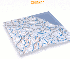 Places with similar names to Xóm Nhân, Vietnam ::
Disclaimer :: Information on this page comes without warranty of any kind |
||
|
Where is Xóm Nhân? Elevation and coordinates ::
Latitude (lat): 18°30'0"N Longitude (lon): 105°23'0"E
Elevation (approx.): 23m (map arrows pan, magnifying glasses zoom) |
||
|
Visiting Xóm Nhân? Hotel/Accommodation ::
Book a hotel in Xóm Nhân Travel Guide ::
Buy a travel guide for Vietnam rental cars ::
car rental offers GPS waypoint ::
download a GPX waypoint (PoI) of Xóm Nhân for your GPS receiver
|
||