|
search place name
|
||
Xuân Hòa (Vietnam)Xuân Hòa is a town in Vietnam. An overview map of the region around Xuân Hòa is displayed below.
regional and 3d topo map of Xuân Hòa, Vietnam ::

Xuân Hòa airports ::
The nearest airport is NHA - Nhatrang, located 96.7 km south of Xuân Hòa.
Nearby towns ::
Phụng Nguyên (1) (0.0km north) //
Cấm Sơn (1) (1.8km west) //
Qui Hậu (2.6km south east) //
Quan Quang (2.6km north west) //
Ðông Lộc (2) (3.7km south) //
Thọ Vực (3) (3.7km north) //
Phú Vang (1) (4.1km north east) //
Phụng Tường (1) (4.1km south east) //
Hạnh Lâm (1) (4.1km south west) //
Thọ Vực (1) (4.1km north east) //
Ngọc Sỏn (3) (5.2km south west) //
Ngọc Lãnh (5.2km north west) //
Ninh Tịnh (1) (5.4km east) //
Liên Trì (3) (5.4km east) //
Phước Hậu (1) (5.4km east) //
Dồng Hòa (1) (5.4km west) //
Tuy Hòa (5.7km east) //
Liên Trì (4) (5.7km east) //
Mậu Lâm (3) (5.7km west) //
Mỹ Thanh (5.8km south) //
Vĩnh Phú (2) (5.8km south) //
Phú Liên (1) (5.8km north) //
Phú Thạnh (3) (6.6km south west) //
Nho Lãm (1) (6.6km south west) //
Ðông Bình (2) (6.6km south east) //
Chíng Nghĩa (2) (6.6km north east) //
Phú Lộc (1) (7.4km south) //
Phú Liên (2) (7.4km north) //
Thạnh Nghiệp (1) (7.6km south) //
[all distances 'as the bird flies' and approximate] 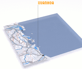 Places with similar names to Xuân Hòa, Vietnam ::
Disclaimer :: Information on this page comes without warranty of any kind |
||
|
Where is Xuân Hòa? Elevation and coordinates ::
Latitude (lat): 13°6'0"N Longitude (lon): 109°15'0"E
Elevation (approx.): 5m (map arrows pan, magnifying glasses zoom) |
||
|
Visiting Xuân Hòa? Hotel/Accommodation ::
Book a hotel in Xuân Hòa Travel Guide ::
Buy a travel guide for Vietnam rental cars ::
car rental offers GPS waypoint ::
download a GPX waypoint (PoI) of Xuân Hòa for your GPS receiver
|
||