|
search place name
|
||
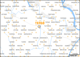
Yên Ðổ (Vietnam)Yên Ðổ is a town in Vietnam. An overview map of the region around Yên Ðổ is displayed below.
regional and 3d topo map of Yên Ðổ, Vietnam ::
Yên Ðổ airports ::
The nearest airport is HAN - Hanoi Noibai Intl, located 85.0 km north of Yên Ðổ.
Nearby towns ::
Bình Lục (1.7km west) //
Mạnh Chu (2.5km south west) //
Mỹ Thọ (2.5km north west) //
Sùng Văn (2.5km south east) //
Cao Dương (2.5km south east) //
Yên Bài (3.7km north) //
Tử Thanh (3.5km east) //
Yên Dương (3.9km south west) //
Ðôn Thự (4.1km north west) //
Khê Cầu (3.9km south east) //
Hưng Cong (4.1km north east) //
Yên Ðề (3.9km north east) //
Nhân Gỉa (5.6km north) //
Thành Th (5.2km east) //
Tiên Khoán (5.2km east) //
Ðồng Du (5.8km north) //
Cổ Viễn (5.8km north) //
Yên Lão (5.8km south) //
Thứ Nhất (5.8km south) //
Tieu Dong (5.8km south) //
Xuân Lôi (5.5km east) //
Duyên Do Khu (5.8km north) //
Hành Nhân (5.8km south) //
Ðống Vọng (6.4km south west) //
Nhân Nhuế (6.4km south east) //
Ngọc Lu (6.4km north east) //
Núi Do (6.9km west) //
Duyên Trường (7.4km south) //
Sơn Nga (7.2km west) //
[all distances 'as the bird flies' and approximate]  Places with similar names to Yên Ðổ, Vietnam ::
Disclaimer :: Information on this page comes without warranty of any kind |
||
|
Where is Yên Ðổ? Elevation and coordinates ::
Latitude (lat): 20°29'0"N Longitude (lon): 106°2'0"E
Elevation (approx.): 4m (map arrows pan, magnifying glasses zoom) |
||
|
Visiting Yên Ðổ? Hotel/Accommodation ::
Book a hotel in Yên Ðổ Travel Guide ::
Buy a travel guide for Vietnam rental cars ::
car rental offers GPS waypoint ::
download a GPX waypoint (PoI) of Yên Ðổ for your GPS receiver
|
||