|
search place name
|
||
Yên Tập (1) (Vĩnh Phú, Vietnam)Yên Tập (1) is a town in the Vĩnh Phú region of Vietnam. An overview map of the region around Yên Tập (1) is displayed below.
regional and 3d topo map of Yên Tập (1), Vietnam ::

Yên Tập (1) airports ::
The nearest airport is HAN - Hanoi Noibai Intl, located 71.0 km east of Yên Tập (1).
Nearby towns ::
Phú Ðộng (1.7km east) //
Sơn Cương (1.7km east) //
Chiểu Ứng (1.7km east) //
Ðông Viên (1.9km north) //
Tình Cương (2.5km south east) //
Thanh Hà (2.5km south east) //
Ta Xá (2.5km south west) //
Thanh Ngã (2.5km north west) //
Chí Chủ (3.7km north) //
Yên Trạch (3.7km north) //
Sơn Tình (3.5km west) //
Làng Dò (4.1km north east) //
Sơn Ngã (4.1km north west) //
Vãn Phú (4.1km north west) //
Trung Hà (5.1km south east) //
Cẩm Khê (5.1km north west) //
Hưng Gia (5.6km south) //
Xóm Cánh (5.2km west) //
Thạch Ðê (5.8km south) //
Yên Lãnh (5.5km east) //
Hưng Long (5.5km east) //
Yên Tập (5.5km west) //
Phụng Thương (6.5km north east) //
Chương Xá (6.5km south west) //
Hiếu (6.5km north west) //
Hương Lung (6.4km south west) //
Ðiêu Lượng (7.6km south) //
Ðuc Mỹ (7.6km south) //
Thanh Lân (7.1km east) //
[all distances 'as the bird flies' and approximate] 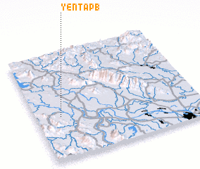 Places with similar names to Yên Tập (1), Vietnam :: Disclaimer :: Information on this page comes without warranty of any kind |
||
|
Where is Yên Tập (1)? Elevation and coordinates ::
Latitude (lat): 21°24'0"N Longitude (lon): 105°9'0"E
Elevation (approx.): 20m (map arrows pan, magnifying glasses zoom) |
||
|
Visiting Yên Tập (1)? Hotel/Accommodation ::
Book a hotel in Yên Tập (1) Travel Guide ::
Buy a travel guide for Vietnam rental cars ::
car rental offers GPS waypoint ::
download a GPX waypoint (PoI) of Yên Tập (1) for your GPS receiver
|
||