|
search place name
|
||
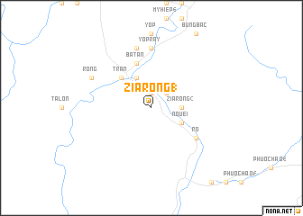
Zia Rong (1) (Quảng Nam-Ðà Nẵng, Vietnam)Zia Rong (1) is a town in the Quảng Nam-Ðà Nẵng region of Vietnam. An overview map of the region around Zia Rong (1) is displayed below.
regional and 3d topo map of Zia Rong (1), Vietnam ::
Zia Rong (1) airports ::
The nearest airport is DAD - Danang Intl, located 61.1 km north east of Zia Rong (1).
Nearby towns ::
Ruoc (1.9km north) //
Ro (1.9km north) //
Young (1.9km north) //
Yhai (2.6km north east) //
Zao Po (3.6km east) //
Zia Rong (2) (3.6km east) //
Bến Giang (4.1km north west) //
Nouei (4.0km south east) //
Tran (5.1km north west) //
Ba Lan (5.8km north) //
Ba Tan (5.8km north) //
Rô (6.5km south east) //
Yo Pray (7.4km north) //
Nga Ho (1) (7.4km north) //
Ðại Giang (2) (7.4km north) //
Ða Giang (7.6km north) //
Rong (8.0km north west) //
[all distances 'as the bird flies' and approximate]  Places with similar names to Zia Rong (1), Vietnam ::
Disclaimer :: Information on this page comes without warranty of any kind |
||
|
Where is Zia Rong (1)? Elevation and coordinates ::
Latitude (lat): 15°39'0"N Longitude (lon): 107°48'0"E
Elevation (approx.): 212m (map arrows pan, magnifying glasses zoom) |
||
|
Visiting Zia Rong (1)? Hotel/Accommodation ::
Book a hotel in Zia Rong (1) Travel Guide ::
Buy a travel guide for Vietnam rental cars ::
car rental offers GPS waypoint ::
download a GPX waypoint (PoI) of Zia Rong (1) for your GPS receiver
|
||