|
search place name
|
||
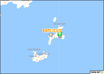
Banlicun (Fujian, China)Banlicun is a town in the Fujian region of China. An overview map of the region around Banlicun is displayed below.
regional and 3d topo map of Banlicun, China ::
Banlicun airports ::
The nearest airport is MZW - Matsu Beigan, located 2.8 km east of Banlicun.
Other airports nearby include FOC - Fuzhou Changle (44.1 km south west), TPE - Taipei Chiang Kai Shek Intl (178.3 km south east), TSA - Taipei Sungshan (202.8 km south east), KNH - Chinmen Shang Yi (256.3 km south west), Nearby towns ::
Pan-li-ts'un (0.1km north west) //
Wu-sha-ts'un (0.7km east) //
Ch'in-pi-ts'un (0.7km east) //
Chung-wo-k'ou (1.0km west) //
Pai-sha-ts'un (1.9km south west) //
T'ang-ch'i-ts'un (2.3km east) //
Hou-wo-ts'un (2.3km east) //
Ch'iao-tzu-ts'un (2.6km north east) //
Shan-ch'ien-ts'un (3.1km north east) //
Ta-ch'iu-ts'un (4.5km north east) //
Fu-hsing-ts'un (6.0km south west) //
Ch'ang-t'an-wo (7.6km south) //
Chieh-shou-ts'un (7.7km south) //
K'o-t'i-wo (8.0km south west) //
Lun-lin-chiao (8.0km south west) //
Ssu-wei-ts'un (8.0km south west) //
Fu-jen-ts'un (8.0km south west) //
Fu-jung-wo (8.0km south west) //
Hsi-wei (8.0km south west) //
Mazu (8.2km south west) //
Fu-wo-ts'un (8.4km south west) //
Chu-lo (8.4km south west) //
Ch'ing-shui-ts'un (8.4km south west) //
Ma-tsu (8.3km south west) //
Mei-shih-ts'un (8.5km south west) //
Jen-ai-ts'un (9.6km south west) //
Chin-sha (10.0km south west) //
[all distances 'as the bird flies' and approximate] 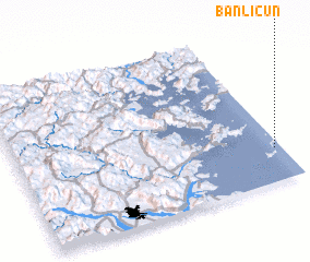 Places with similar names to Banlicun, China ::
// Ban Ao Luk Nua (TH)
// Ban Lak Uan (TH)
// Bānlakān (IR)
// Ban Luekon (NG)
// Ban Lagnao (LA)
// Ban Lai-Gnai (LA)
// Ban Laki Noy (LA)
// Ban Laogna (LA)
// Ban Laogna (LA)
// Ban Laogna (LA)
Disclaimer :: Information on this page comes without warranty of any kind |
||
|
Where is Banlicun? Elevation and coordinates ::
Latitude (lat): 26°12'54"N Longitude (lon): 119°58'36"E
Elevation (approx.): -32768m (map arrows pan, magnifying glasses zoom) |
||
|
Visiting Banlicun? Hotel/Accommodation ::
Book a hotel in Banlicun Travel Guide ::
Buy a travel guide for China rental cars ::
car rental offers GPS waypoint ::
download a GPX waypoint (PoI) of Banlicun for your GPS receiver
|
||