|
search place name
|
||
Changshancun (Hainan, China)Changshancun is a town in the Hainan region of China. An overview map of the region around Changshancun is displayed below.
regional and 3d topo map of Changshancun, China ::

Nearby towns ::
Qingtian (1.4km east) //
Danicun (1.7km north east) //
Tielu (2.0km north) //
Linwang (2.5km north east) //
Shentiancun (2.6km east) //
Shangzhuluocun (3.0km west) //
Wanyi (3.6km south east) //
Dingwencun (4.2km east) //
Houhiacun (4.5km north east) //
Shiguitianwei (4.9km east) //
Yalongwan (5.4km south east) //
Liupan (5.5km south west) //
Shangwanpo (6.5km north) //
Longpo (6.6km south east) //
Tianpu (6.5km south west) //
Yalong (6.7km south east) //
Tiandu (6.7km north west) //
Liaolianxia (6.9km north west) //
Tenghai (6.8km east) //
Linwang (7.2km north east) //
Zhuangda (10.3km north east) //
[all distances 'as the bird flies' and approximate] 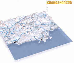 Places with similar names to Changshancun, China ::
// Changch'ung-ni (KP)
// Shangtiancun (CN)
Disclaimer :: Information on this page comes without warranty of any kind |
||
|
Where is Changshancun? Elevation and coordinates ::
Latitude (lat): 18°16'0"N Longitude (lon): 109°40'0"E
Elevation (approx.): 4m (map arrows pan, magnifying glasses zoom) |
||
|
Visiting Changshancun? Hotel/Accommodation ::
Book a hotel in Changshancun Travel Guide ::
Buy a travel guide for China rental cars ::
car rental offers GPS waypoint ::
download a GPX waypoint (PoI) of Changshancun for your GPS receiver
|
||