|
search place name
|
||
Chenjiazhai (Jiangsu, China)Chenjiazhai is a town in the Jiangsu region of China. An overview map of the region around Chenjiazhai is displayed below.
regional and 3d topo map of Chenjiazhai, China ::

Chenjiazhai airports ::
The nearest airport is SHA - Shanghai Hongqiao Intl, located 91.2 km south of Chenjiazhai.
Other airports nearby include HGH - Hangzhou Xiaoshan (221.3 km south west), Nearby towns ::
Chipengzhen (2.6km south east) //
Yixingzhen (2.7km west) //
Haihong (3.6km south) //
Jiangjiazhen (3.5km south west) //
Liujia (5.5km north) //
Bazhangzhen (4.8km east) //
Toujia (4.9km north east) //
Sanxingzhen (5.1km south east) //
Zhizhongdadui (5.2km north west) //
Yujiadian (5.3km west) //
Liuhao (6.4km north) //
Nanxingzhen (6.9km south) //
Baochang (7.0km north west) //
Tongxingnongchang (6.7km east) //
Xining (7.4km north east) //
Tongxing (6.9km east) //
Xuejiadai (8.0km south west) //
Juxingzhen (7.6km south east) //
Sanhe (7.4km south west) //
Baochangyuchang (7.8km north west) //
Wannian (8.0km south west) //
Tianfen (8.3km north east) //
Fengnandadui (9.2km south west) //
Xinyuzhen (9.1km north west) //
Yuelai (9.6km south west) //
[all distances 'as the bird flies' and approximate] 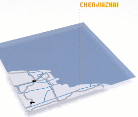 Places with similar names to Chenjiazhai, China ::
// Chenjiazha (CN)
// Chenjiazhai (CN)
// Chenjiazhai (CN)
// Shenjiazhai (CN)
// Tianjiazhai (CN)
// Tianjiazhai (CN)
Disclaimer :: Information on this page comes without warranty of any kind |
||
|
Where is Chenjiazhai? Elevation and coordinates ::
Latitude (lat): 32°0'39"N Longitude (lon): 121°28'56"E
Elevation (approx.): 3m (map arrows pan, magnifying glasses zoom) |
||
|
Visiting Chenjiazhai? Hotel/Accommodation ::
Book a hotel in Chenjiazhai Travel Guide ::
Buy a travel guide for China rental cars ::
car rental offers GPS waypoint ::
download a GPX waypoint (PoI) of Chenjiazhai for your GPS receiver
|
||