|
search place name
|
||
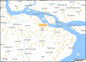
Da'ao (Zhejiang, China)Da'ao is a town in the Zhejiang region of China. An overview map of the region around Da'ao is displayed below.
regional and 3d topo map of Da'ao, China ::
Da'ao airports ::
The nearest airport is MZW - Matsu Beigan, located 205.4 km south of Da'ao.
Other airports nearby include NGB - Ninbo Lishe (218.9 km north), Nearby towns ::
Zhangyuanqiao (0.9km north) //
Da'aoxi (1.3km south west) //
Shangzhuang (1.6km north) //
Xiajiapai (1.7km west) //
Xiangdongyan (2.0km south) //
Zhuangyuanqiao (1.9km north east) //
Xiaokeng'er (2.1km south west) //
Yutian (2.5km north) //
Sanyang (2.5km west) //
Siqian (2.8km north west) //
Xitai'ao (2.7km east) //
Dachashan (3.1km south) //
Hengjie (3.0km north east) //
Xiabu (3.2km north west) //
Shun'ao (3.5km south west) //
Houyang (3.2km west) //
Zhang'ao (3.5km south west) //
Puzhouzhen (4.0km north) //
Chidi (3.7km west) //
Shanghebin (4.0km south east) //
Yuandi (3.9km west) //
Tangjiaqiao (4.3km north west) //
Yaonaozhen (4.1km east) //
Dilingxia (4.0km east) //
Shangsha (4.7km north east) //
Yangtian (4.7km north west) //
Yaoxi (4.7km south east) //
Bailouxia (4.5km east) //
Laotu (4.8km north east) //
[all distances 'as the bird flies' and approximate] 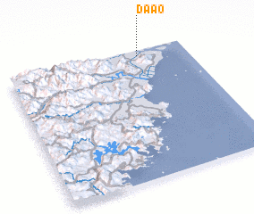 Places with similar names to Da'ao, China ::
Disclaimer :: Information on this page comes without warranty of any kind |
||
|
Where is Da'ao? Elevation and coordinates ::
Latitude (lat): 27°57'30"N Longitude (lon): 120°43'59"E
Elevation (approx.): 8m (map arrows pan, magnifying glasses zoom) |
||
|
Visiting Da'ao? Hotel/Accommodation ::
Book a hotel in Da'ao Travel Guide ::
Buy a travel guide for China rental cars ::
car rental offers GPS waypoint ::
download a GPX waypoint (PoI) of Da'ao for your GPS receiver
|
||