|
search place name
|
||
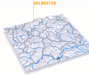
Dalangtou (Guangdong, China)Dalangtou is a town in the Guangdong region of China. An overview map of the region around Dalangtou is displayed below.
regional and 3d topo map of Dalangtou, China ::

Dalangtou airports ::
The nearest airport is CAN - Guangzhou Baiyun Intl, located 104.5 km east of Dalangtou.
Other airports nearby include SZX - Shenzhen Baoan Intl (181.3 km south east), MFM - Macau Intl (197.9 km south east), HKG - Hong Kong Intl (210.6 km south east), Nearby towns ::
 Places with similar names to Dalangtou, China ::
// Dulaney Gate (US)
// Tulanguda (IN)
// Talunkota (ID)
// Tualancut (ID)
// Tulengut (KZ)
// Talancuda (LK)
// Talanguita (HN)
// Talanguita (HN)
// Diélinkoto (ML)
// Dal'niy Kut (RU)
Disclaimer :: Information on this page comes without warranty of any kind |
||
|
Where is Dalangtou? Elevation and coordinates ::
Latitude (lat): 23°27'27"N Longitude (lon): 112°16'43"E
Elevation (approx.): 459m (map arrows pan, magnifying glasses zoom) |
||
|
Visiting Dalangtou? Hotel/Accommodation ::
Book a hotel in Dalangtou Travel Guide ::
Buy a travel guide for China rental cars ::
car rental offers GPS waypoint ::
download a GPX waypoint (PoI) of Dalangtou for your GPS receiver
|
||