|
search place name
|
||
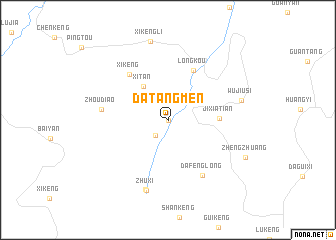
Datangmen (Zhejiang, China)Datangmen is a town in the Zhejiang region of China. An overview map of the region around Datangmen is displayed below.
regional and 3d topo map of Datangmen, China ::
Datangmen airports ::
The nearest airport is HGH - Hangzhou Xiaoshan, located 263.7 km north east of Datangmen.
Nearby towns ::
Dadimen (0.0km north) //
Huangnifan (2.1km south west) //
Xitan (4.4km north west) //
Jixiatian (5.1km east) //
Longkou (6.0km north east) //
Xikeng (6.3km north west) //
Dafenglong (7.1km south east) //
Zhoudiao (6.6km west) //
Zhulong (8.1km south) //
Zhuxi (8.2km south) //
Wujiusi (7.6km east) //
Xikengli (9.0km north) //
Zhengzhuang (8.7km south east) //
[all distances 'as the bird flies' and approximate] 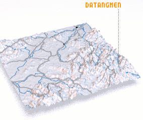 Places with similar names to Datangmen, China ::
// Datangmian (CN)
// Datangmian (CN)
Disclaimer :: Information on this page comes without warranty of any kind |
||
|
Where is Datangmen? Elevation and coordinates ::
Latitude (lat): 28°15'15"N Longitude (lon): 118°55'19"E
Elevation (approx.): 534m (map arrows pan, magnifying glasses zoom) |
||
|
Visiting Datangmen? Hotel/Accommodation ::
Book a hotel in Datangmen Travel Guide ::
Buy a travel guide for China rental cars ::
car rental offers GPS waypoint ::
download a GPX waypoint (PoI) of Datangmen for your GPS receiver
|
||