|
search place name
|
||
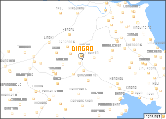
Ding'ao (Zhejiang, China)Ding'ao is a town in the Zhejiang region of China. An overview map of the region around Ding'ao is displayed below.
regional and 3d topo map of Ding'ao, China ::
Ding'ao airports ::
The nearest airport is MZW - Matsu Beigan, located 145.7 km south of Ding'ao.
Other airports nearby include FOC - Fuzhou Changle (188.0 km south west), Nearby towns ::
Zaoxizhen (1.1km south west) //
Xiacun (2.2km north) //
Fanzhi (2.3km north) //
Yangfugong (2.5km south) //
Baifen (2.3km east) //
Jiangbian (2.8km north west) //
Panzhuang (3.9km south west) //
Dangfeng (4.2km north west) //
Gaocuo (4.2km west) //
Qingshannei (4.9km south) //
Wayaotou (5.4km east) //
Xixin (5.5km west) //
Hengpu (6.3km north west) //
Nanchaliao (5.9km east) //
Tingnan (6.3km south west) //
Wanglizhen (6.2km east) //
Shimen (6.4km south west) //
Maoxu (6.6km south west) //
Daxinyang (7.8km south) //
Shizi (7.4km south west) //
Lingxi (7.8km north west) //
Tielong (8.0km north east) //
Badai (8.0km north east) //
Youjiakeng (8.3km south east) //
Xiazhai (9.2km south) //
Kengkou (8.8km south east) //
Houyangzeng (9.2km north east) //
Yishanzhen (9.1km north east) //
Zhoujiache (9.6km north east) //
[all distances 'as the bird flies' and approximate] 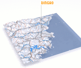 Places with similar names to Ding'ao, China ::
Disclaimer :: Information on this page comes without warranty of any kind |
||
|
Where is Ding'ao? Elevation and coordinates ::
Latitude (lat): 27°28'21"N Longitude (lon): 120°27'43"E
Elevation (approx.): 22m (map arrows pan, magnifying glasses zoom) |
||
|
Visiting Ding'ao? Hotel/Accommodation ::
Book a hotel in Ding'ao Travel Guide ::
Buy a travel guide for China rental cars ::
car rental offers GPS waypoint ::
download a GPX waypoint (PoI) of Ding'ao for your GPS receiver
|
||