|
search place name
|
||
Dongjiata (Anhui, China)Dongjiata is a town in the Anhui region of China. An overview map of the region around Dongjiata is displayed below.
regional and 3d topo map of Dongjiata, China ::

Dongjiata airports ::
The nearest airport is NKG - Nanjing Lukou, located 152.2 km north east of Dongjiata.
Other airports nearby include HFE - Hefei Luogang (166.9 km north west), Nearby towns ::
Malingfang (2.8km south) //
Niujiaokengkou (3.3km north) //
Tangli (3.9km south east) //
Zhoushan (5.2km north east) //
Maolin (5.2km north east) //
Shuidong (5.3km west) //
Chencun (5.9km south west) //
Dongjia (5.9km north west) //
Tongshan (6.4km south east) //
Lingjiawan (6.1km east) //
Nanrong (6.5km east) //
Libadian (7.7km north) //
Fengcun (7.6km north east) //
Chenjia (7.9km south west) //
Lingtang (8.4km north east) //
Baocun (9.4km north west) //
Shangtongshan (10.3km south east) //
Xiawuli (10.0km north east) //
[all distances 'as the bird flies' and approximate] 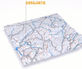 Places with similar names to Dongjiata, China ::
// Tanakajd (HU)
// Don Quijote (CO)
// Dengjiata (CN)
// Dongjietou (CN)
// Dongjituo (CN)
// Tangjiata (CN)
// Tangjiatou (CN)
Disclaimer :: Information on this page comes without warranty of any kind |
||
|
Where is Dongjiata? Elevation and coordinates ::
Latitude (lat): 30°29'30"N Longitude (lon): 118°12'15"E
Elevation (approx.): 136m (map arrows pan, magnifying glasses zoom) |
||
|
Visiting Dongjiata? Hotel/Accommodation ::
Book a hotel in Dongjiata Travel Guide ::
Buy a travel guide for China rental cars ::
car rental offers GPS waypoint ::
download a GPX waypoint (PoI) of Dongjiata for your GPS receiver
|
||