|
search place name
|
||
Fangkeng (Zhejiang, China)Fangkeng is a town in the Zhejiang region of China. An overview map of the region around Fangkeng is displayed below.
regional and 3d topo map of Fangkeng, China ::

Fangkeng airports ::
The nearest airport is HGH - Hangzhou Xiaoshan, located 141.5 km north of Fangkeng.
Other airports nearby include NGB - Ninbo Lishe (175.3 km north east), Nearby towns ::
Cixi (4.0km north east) //
Shangjiadao (4.5km south west) //
Baziqiang (4.6km south east) //
Zhaishan (6.1km north) //
Dongfengyingshi (6.3km south) //
Changgen (7.2km north west) //
Xinting (7.0km west) //
Xiadian (8.5km south east) //
Longtanxia (8.9km north) //
Shangyang (9.6km north east) //
Zhengdian (10.4km north west) //
[all distances 'as the bird flies' and approximate] 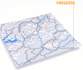 Places with similar names to Fangkeng, China ::
// Fang-k'eng (TW)
// Feng-k'ung (TW)
// Phieng Quang (VN)
// Phụng Công (VN)
// Phung Công (VN)
// Phương Cương (VN)
// Fangkeng (CN)
// Fangkeng (CN)
// Fangqiang (CN)
// Fengcunke (CN)
Disclaimer :: Information on this page comes without warranty of any kind |
||
|
Where is Fangkeng? Elevation and coordinates ::
Latitude (lat): 29°2'39"N Longitude (lon): 119°53'29"E
Elevation (approx.): 279m (map arrows pan, magnifying glasses zoom) |
||
|
Visiting Fangkeng? Hotel/Accommodation ::
Book a hotel in Fangkeng Travel Guide ::
Buy a travel guide for China rental cars ::
car rental offers GPS waypoint ::
download a GPX waypoint (PoI) of Fangkeng for your GPS receiver
|
||