|
search place name
|
||
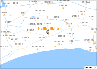
Fengcheng (Shanghai, China)Fengcheng is a town in the Shanghai region of China. An overview map of the region around Fengcheng is displayed below.
regional and 3d topo map of Fengcheng, China ::
Fengcheng airports ::
The nearest airport is SHA - Shanghai Hongqiao Intl, located 42.3 km north west of Fengcheng.
Other airports nearby include NGB - Ninbo Lishe (122.4 km south), HGH - Hangzhou Xiaoshan (138.6 km south west), Nearby towns ::
Touqiao (3.3km north) //
Tangwai (3.2km south west) //
Taiping (4.5km east) //
Liaoyuan (5.1km south east) //
Yanhaicun (5.0km south east) //
Donghejiaqiao (5.3km north west) //
Tongxinjiudui (5.7km south east) //
Xinshi (6.3km north) //
Qingcun (6.0km west) //
Qingnianqiao (6.7km south west) //
Liangdian (7.1km north west) //
Daqiao (7.5km north east) //
Ping'an (7.3km east) //
Situan (7.6km north east) //
Zhoujialong (8.9km north) //
Wusi (8.4km south east) //
[all distances 'as the bird flies' and approximate] 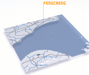 Places with similar names to Fengcheng, China ::
// Fengcheng (CN)
// Feng-shang (TW)
// Fengcheng (CN)
// Fangcheng (CN)
// Fangcheng (CN)
// Fangchang (CN)
// Fangcheng (CN)
// Fangchong (CN)
// Fangshang (CN)
// Fangshengou (CN)
Disclaimer :: Information on this page comes without warranty of any kind |
||
|
Where is Fengcheng? Elevation and coordinates ::
Latitude (lat): 30°55'12"N Longitude (lon): 121°38'22"E
Elevation (approx.): 8m (map arrows pan, magnifying glasses zoom) |
||
|
Visiting Fengcheng? Hotel/Accommodation ::
Book a hotel in Fengcheng Travel Guide ::
Buy a travel guide for China rental cars ::
car rental offers GPS waypoint ::
download a GPX waypoint (PoI) of Fengcheng for your GPS receiver
|
||