|
search place name
|
||
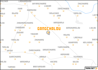
Gangchalou (Anhui, China)Gangchalou is a town in the Anhui region of China. An overview map of the region around Gangchalou is displayed below.
regional and 3d topo map of Gangchalou, China ::
Nearby towns ::
Zhuhuang (4.1km south west) //
Wangqianji (4.8km north east) //
Youdian (4.7km west) //
Dasunzhuang (6.5km south) //
Majing (5.7km east) //
Jiwa (7.2km north east) //
Yanjizhen (7.6km north) //
Yuanzhuang (7.2km south east) //
Wanggaotaizi (6.7km north west) //
Dachenzhuang (6.7km south west) //
Zhaozhuang (8.1km south west) //
Wangtang (8.7km north west) //
Hongmiao (9.7km south east) //
Huangkou (10.3km north west) //
[all distances 'as the bird flies' and approximate]  Places with similar names to Gangchalou, China ::
// Conocchiella (IT)
// Kānksiāli (BD)
// Kangch'ŏl-li (KP)
// Kingshill (US)
// Kungshälla (SE)
// Qingshila (CN)
Disclaimer :: Information on this page comes without warranty of any kind |
||
|
Where is Gangchalou? Elevation and coordinates ::
Latitude (lat): 34°17'0"N Longitude (lon): 116°45'0"E
Elevation (approx.): 39m (map arrows pan, magnifying glasses zoom) |
||
|
Visiting Gangchalou? Hotel/Accommodation ::
Book a hotel in Gangchalou Travel Guide ::
Buy a travel guide for China rental cars ::
car rental offers GPS waypoint ::
download a GPX waypoint (PoI) of Gangchalou for your GPS receiver
|
||