|
search place name
|
||
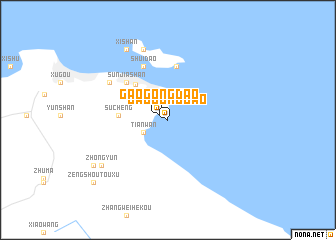
Gaogongdao (Jiangsu, China)Gaogongdao is a town in the Jiangsu region of China. An overview map of the region around Gaogongdao is displayed below.
regional and 3d topo map of Gaogongdao, China ::
Gaogongdao airports ::
The nearest airport is TAO - Qingdao Liuting, located 192.4 km north east of Gaogongdao.
Nearby towns ::
Gaogongdao (0.9km north west) //
Tianwan (2.7km south west) //
Lianyungang (5.0km north west) //
Sucheng (4.6km west) //
Dongliandao (6.1km north) //
Sunjiashan (5.6km north west) //
Shuidao (6.4km north) //
Miaolingcun (6.8km north west) //
Xiliandao (8.2km north) //
Zhongyun (7.9km south west) //
Dongshan (8.7km north west) //
Xishan (8.7km north west) //
Banqiao (8.5km south west) //
Zengshoutouxu (9.8km south west) //
[all distances 'as the bird flies' and approximate] 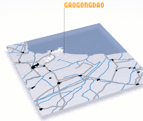 Places with similar names to Gaogongdao, China ::
// Kākankote (IN)
// Kāki na Kot (IN)
// Ccanocota (PE)
// Kokounkoudou (GN)
// Gaogongdao (CN)
// Goicangdoi (CN)
// Qiugongdu (CN)
Disclaimer :: Information on this page comes without warranty of any kind |
||
|
Where is Gaogongdao? Elevation and coordinates ::
Latitude (lat): 34°41'45"N Longitude (lon): 119°28'30"E
Elevation (approx.): -32768m (map arrows pan, magnifying glasses zoom) |
||
|
Visiting Gaogongdao? Hotel/Accommodation ::
Book a hotel in Gaogongdao Travel Guide ::
Buy a travel guide for China rental cars ::
car rental offers GPS waypoint ::
download a GPX waypoint (PoI) of Gaogongdao for your GPS receiver
|
||