|
search place name
|
||
Huangnitang (Anhui, China)Huangnitang is a town in the Anhui region of China. An overview map of the region around Huangnitang is displayed below.
regional and 3d topo map of Huangnitang, China ::
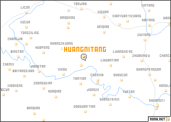
Nearby towns ::
Shitian Linchang (1.2km south west) //
Chenxia (4.8km south east) //
Yantian (5.0km south) //
Chencun (5.3km south east) //
Lihuantian (4.9km east) //
Xikou (5.2km south west) //
Shangzhuang (5.2km north west) //
Weiqiao (7.2km north east) //
Jiongxi (7.6km south) //
Dangjinjie (8.0km north west) //
Liwangkeng (7.3km east) //
Shoucun (8.0km south east) //
Waiqukou (8.9km north) //
Huaqiao (9.7km south west) //
Landu (10.3km north east) //
[all distances 'as the bird flies' and approximate] 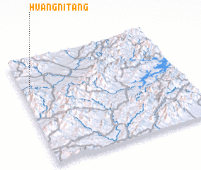 Places with similar names to Huangnitang, China ::
// Hongnae-dong (KP)
// Hŭngun-dong (KP)
// Haenggun-dong (KR)
// Hongnae-dong (KR)
// Hongŭn-dong (KR)
// Huang-ni-t'ang (TW)
// Huangnitang (CN)
// Huangnidong (CN)
// Huangnitang (CN)
// Huangnitang (CN)
Disclaimer :: Information on this page comes without warranty of any kind |
||
|
Where is Huangnitang? Elevation and coordinates ::
Latitude (lat): 29°43'0"N Longitude (lon): 118°3'0"E
Elevation (approx.): 171m (map arrows pan, magnifying glasses zoom) |
||
|
Visiting Huangnitang? Hotel/Accommodation ::
Book a hotel in Huangnitang Travel Guide ::
Buy a travel guide for China rental cars ::
car rental offers GPS waypoint ::
download a GPX waypoint (PoI) of Huangnitang for your GPS receiver
|
||