|
search place name
|
||
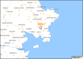
Huli (Zhejiang, China)Huli is a town in the Zhejiang region of China. An overview map of the region around Huli is displayed below.
regional and 3d topo map of Huli, China ::
Huli airports ::
The nearest airport is MZW - Matsu Beigan, located 145.0 km south west of Huli.
Other airports nearby include FOC - Fuzhou Changle (189.0 km south west), Nearby towns ::
Longpanji (1.0km south east) //
Huangni'ao (1.9km north west) //
Jinxiangzhen (2.3km north) //
Dayu (2.5km south west) //
Shiping (2.5km east) //
Zhangliangshan (3.5km north east) //
Linjiadong (3.9km north west) //
Da'ao (3.9km south west) //
Banjialian (4.9km north) //
Gongjiao (5.3km south east) //
Lingfeng (5.4km north) //
Xiao'ao (5.0km west) //
Jiangjun (5.5km north west) //
Xiakou (5.9km north) //
Yantingzhen (6.0km north east) //
Qianwu (6.4km north west) //
Yangdizhang (7.1km north) //
Honglingxia (7.0km north east) //
Xincheng (7.3km north) //
Linjiata (7.1km north west) //
Xiangqiao (7.6km north west) //
Shapo (7.4km west) //
Yangshantou (7.4km west) //
Qiankuzhen (8.2km north west) //
Nantou (7.9km south west) //
Longsha (7.7km west) //
Pacaozhen (8.6km north) //
Kengkou (7.9km west) //
Wangjiashan (9.0km south west) //
[all distances 'as the bird flies' and approximate] 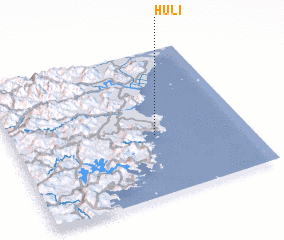 Places with similar names to Huli, China ::
Disclaimer :: Information on this page comes without warranty of any kind |
||
|
Where is Huli? Elevation and coordinates ::
Latitude (lat): 27°24'49"N Longitude (lon): 120°36'39"E
Elevation (approx.): 67m (map arrows pan, magnifying glasses zoom) |
||
|
Visiting Huli? Hotel/Accommodation ::
Book a hotel in Huli Travel Guide ::
Buy a travel guide for China rental cars ::
car rental offers GPS waypoint ::
download a GPX waypoint (PoI) of Huli for your GPS receiver
|
||