|
search place name
|
||
Huqiaodadui (Jiangsu, China)Huqiaodadui is a town in the Jiangsu region of China. An overview map of the region around Huqiaodadui is displayed below.
regional and 3d topo map of Huqiaodadui, China ::

Huqiaodadui airports ::
The nearest airport is SHA - Shanghai Hongqiao Intl, located 79.4 km east of Huqiaodadui.
Other airports nearby include HGH - Hangzhou Xiaoshan (101.3 km south), NKG - Nanjing Lukou (169.9 km north west), NGB - Ninbo Lishe (172.2 km south east), Nearby towns ::
Puzhuang (2.6km north) //
Maoqi (2.6km south east) //
Hengjing (3.7km north east) //
Lindu (3.4km east) //
Shangzhuangdadui (4.4km north) //
Houhangqiao (5.5km north) //
Ducun (5.4km south west) //
Yijiadang (6.2km east) //
Qianzhuang (7.0km north east) //
Xugang (7.0km north east) //
Majiachang (8.4km north) //
Xuejiawan (8.3km north east) //
Wushantou (10.5km north east) //
[all distances 'as the bird flies' and approximate] 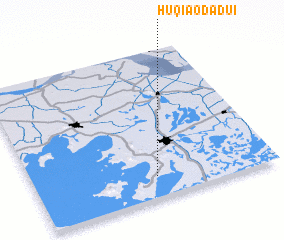 Places with similar names to Huqiaodadui, China ::
// Hakodate (JP)
// Houquetot (FR)
// Huaycatata (BO)
// Heqiaodadui (CN)
// Hectot (FR)
// Houquetot (FR)
Disclaimer :: Information on this page comes without warranty of any kind |
||
|
Where is Huqiaodadui? Elevation and coordinates ::
Latitude (lat): 31°8'28"N Longitude (lon): 120°30'22"E
Elevation (approx.): 3m (map arrows pan, magnifying glasses zoom) |
||
|
Visiting Huqiaodadui? Hotel/Accommodation ::
Book a hotel in Huqiaodadui Travel Guide ::
Buy a travel guide for China rental cars ::
car rental offers GPS waypoint ::
download a GPX waypoint (PoI) of Huqiaodadui for your GPS receiver
|
||