|
search place name
|
||
Jiangdian (Anhui, China)Jiangdian is a town in the Anhui region of China. An overview map of the region around Jiangdian is displayed below.
regional and 3d topo map of Jiangdian, China ::

Jiangdian airports ::
The nearest airport is HFE - Hefei Luogang, located 96.5 km east of Jiangdian.
Nearby towns ::
Bianzhuang (3.4km east) //
Huishou (3.7km west) //
Zhengyingzi (4.1km south east) //
Chenxinzhuang (4.4km north west) //
Yandunji (4.7km north east) //
Chenjiazhuang (5.3km south) //
Nanyuemiao (7.5km south) //
Qingliangsi (7.7km north west) //
Youfangqiao (8.1km south) //
Xuji (7.0km east) //
Daling (7.8km south east) //
Hejialou (7.9km north west) //
Fenlukou (8.6km south east) //
Miaomenkou (8.5km north east) //
Xiajiazhuang (8.0km north east) //
Yangongmiao (8.6km south east) //
[all distances 'as the bird flies' and approximate] 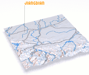 Places with similar names to Jiangdian, China ::
// Ginictan (PH)
// Johnky Town (LR)
// Giồng Ðinh (VN)
// Giồng Dinh (VN)
// Giồng Dinh (VN)
// Jiangdian (CN)
// Jiangdian (CN)
// Jiangdian (CN)
// Jiangdian (CN)
// Jiangdian (CN)
Disclaimer :: Information on this page comes without warranty of any kind |
||
|
Where is Jiangdian? Elevation and coordinates ::
Latitude (lat): 31°49'15"N Longitude (lon): 116°16'51"E
Elevation (approx.): 63m (map arrows pan, magnifying glasses zoom) |
||
|
Visiting Jiangdian? Hotel/Accommodation ::
Book a hotel in Jiangdian Travel Guide ::
Buy a travel guide for China rental cars ::
car rental offers GPS waypoint ::
download a GPX waypoint (PoI) of Jiangdian for your GPS receiver
|
||