|
search place name
|
||
Longtankeng (Zhejiang, China)Longtankeng is a town in the Zhejiang region of China. An overview map of the region around Longtankeng is displayed below.
regional and 3d topo map of Longtankeng, China ::

Longtankeng airports ::
The nearest airport is NGB - Ninbo Lishe, located 42.8 km north of Longtankeng.
Other airports nearby include HGH - Hangzhou Xiaoshan (126.9 km north west), SHA - Shanghai Hongqiao Intl (194.4 km north), Nearby towns ::
Changyang (3.6km west) //
Shanxialiu (4.4km south) //
Lingkou (4.4km north west) //
Zhujia (4.4km north east) //
Jiyibao (4.4km east) //
Shadi (5.0km south west) //
Zixi (4.9km east) //
Shijia (5.6km north) //
Shangdushan (5.1km west) //
Xiangshan (6.0km north) //
Fengtan (6.3km south) //
Shenzhenzhen (5.7km south west) //
Changshang (6.3km north west) //
Xidianzhen (6.3km north east) //
Lantian (7.2km south west) //
Dacai (7.1km north west) //
Xi'ao (7.9km north) //
Lishandeng (8.1km north west) //
Dali (7.8km west) //
Cuijia (8.7km north east) //
Meilinzhen (8.9km south east) //
Zhangjiaxi (8.4km south east) //
Wenquan (8.8km south west) //
Changzhao (10.2km north west) //
Nanxilinchang (11.5km south west) //
[all distances 'as the bird flies' and approximate] 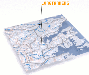 Places with similar names to Longtankeng, China ::
// Làng Tung Ang (VN)
// Longtankeng (CN)
Disclaimer :: Information on this page comes without warranty of any kind |
||
|
Where is Longtankeng? Elevation and coordinates ::
Latitude (lat): 29°26'43"N Longitude (lon): 121°23'27"E
Elevation (approx.): 301m (map arrows pan, magnifying glasses zoom) |
||
|
Visiting Longtankeng? Hotel/Accommodation ::
Book a hotel in Longtankeng Travel Guide ::
Buy a travel guide for China rental cars ::
car rental offers GPS waypoint ::
download a GPX waypoint (PoI) of Longtankeng for your GPS receiver
|
||