|
search place name
|
||
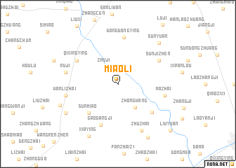
Miaoli (Anhui, China)Miaoli is a town in the Anhui region of China. An overview map of the region around Miaoli is displayed below.
regional and 3d topo map of Miaoli, China ::
Miaoli airports ::
The nearest airport is HFE - Hefei Luogang, located 199.3 km south east of Miaoli.
Nearby towns ::
Zhuji (3.2km north west) //
Zhongwang (4.4km south east) //
Sunmiao (6.0km south west) //
Gaodangji (6.9km south) //
Wangshi (6.4km south east) //
Dongdongying (7.5km north) //
Qixingying (6.6km north west) //
Sunjizhen (6.6km north east) //
Mazhai (6.5km east) //
Zhuzhai (8.0km south east) //
Ruji (7.2km west) //
Wanlizhai (7.2km west) //
Sunyuan (8.5km north east) //
Xiaying (9.2km south west) //
Ruxiying (8.4km south west) //
Dongcheng (9.4km south east) //
Liuyuan (10.2km south east) //
[all distances 'as the bird flies' and approximate] 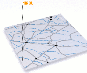 Places with similar names to Miaoli, China ::
Disclaimer :: Information on this page comes without warranty of any kind |
||
|
Where is Miaoli? Elevation and coordinates ::
Latitude (lat): 33°13'0"N Longitude (lon): 116°1'30"E
Elevation (approx.): 30m (map arrows pan, magnifying glasses zoom) |
||
|
Visiting Miaoli? Hotel/Accommodation ::
Book a hotel in Miaoli Travel Guide ::
Buy a travel guide for China rental cars ::
car rental offers GPS waypoint ::
download a GPX waypoint (PoI) of Miaoli for your GPS receiver
|
||