|
search place name
|
||
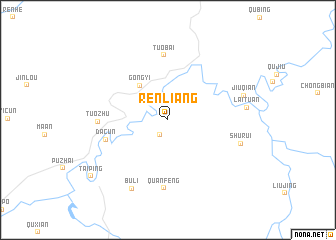
Renliang (Guangxi, China)Renliang is a town in the Guangxi region of China. An overview map of the region around Renliang is displayed below.
regional and 3d topo map of Renliang, China ::
Renliang airports ::
The nearest airport is NNG - Nanning Wuxu, located 77.2 km east of Renliang.
Other airports nearby include HAN - Hanoi Noibai Intl (217.8 km south west), Nearby towns ::
Qu'ao (1.9km south west) //
Gongyi (4.8km north west) //
Tuobai (7.2km north) //
Dacun (6.8km west) //
Quanfeng (7.6km south) //
Tuozhu (7.2km west) //
Shurui (8.0km east) //
Buli (8.5km south west) //
Jiuqian (8.3km east) //
Laituan (8.3km east) //
Taiping (10.2km south west) //
[all distances 'as the bird flies' and approximate] 
Disclaimer :: Information on this page comes without warranty of any kind |
||
|
Where is Renliang? Elevation and coordinates ::
Latitude (lat): 22°28'6"N Longitude (lon): 107°26'13"E
Elevation (approx.): 127m (map arrows pan, magnifying glasses zoom) |
||
|
Visiting Renliang? Hotel/Accommodation ::
Book a hotel in Renliang Travel Guide ::
Buy a travel guide for China rental cars ::
car rental offers GPS waypoint ::
download a GPX waypoint (PoI) of Renliang for your GPS receiver
|
||