|
search place name
|
||
Renxi (Zhejiang, China)Renxi is a town in the Zhejiang region of China. An overview map of the region around Renxi is displayed below.
regional and 3d topo map of Renxi, China ::

Renxi airports ::
The nearest airport is NGB - Ninbo Lishe, located 203.6 km north of Renxi.
Other airports nearby include MZW - Matsu Beigan (220.7 km south), Nearby towns ::
Hengyu (0.8km south) //
Xiang'ao (1.8km east) //
Xi'ao (2.1km north) //
Dong'ao (2.2km north east) //
Ma'ao (2.8km west) //
Hongduqiao (4.2km south) //
Xiye (4.5km north west) //
Lingxia (4.6km south west) //
Dongzhang (4.9km north) //
Huang'ao (4.5km east) //
Wuniu (5.1km south) //
Wangzhai (5.2km south) //
Hangchan (4.8km west) //
Shibalong (5.3km north east) //
Wuyan (5.7km north) //
Mingyu (6.0km south) //
Wannan (5.6km south east) //
Gao'ao (6.1km south) //
Shangchen (5.5km east) //
Wanjia (5.7km south east) //
Baishizhen (5.9km east) //
Banling (6.2km west) //
Wuniu (7.3km south) //
Shangni (7.0km north east) //
Longtan (7.4km north) //
Ruili (7.8km south) //
Beibaixiangzhen (7.4km south east) //
Guantou (8.0km south) //
Guacai (7.8km south west) //
[all distances 'as the bird flies' and approximate] 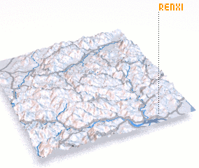 Places with similar names to Renxi, China ::
Disclaimer :: Information on this page comes without warranty of any kind |
||
|
Where is Renxi? Elevation and coordinates ::
Latitude (lat): 28°5'5"N Longitude (lon): 120°47'56"E
Elevation (approx.): 6m (map arrows pan, magnifying glasses zoom) |
||
|
Visiting Renxi? Hotel/Accommodation ::
Book a hotel in Renxi Travel Guide ::
Buy a travel guide for China rental cars ::
car rental offers GPS waypoint ::
download a GPX waypoint (PoI) of Renxi for your GPS receiver
|
||