|
search place name
|
||
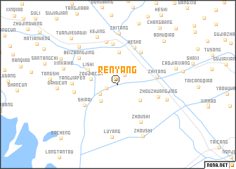
Renyang (Jiangsu, China)Renyang is a town in the Jiangsu region of China. An overview map of the region around Renyang is displayed below.
regional and 3d topo map of Renyang, China ::
Renyang airports ::
The nearest airport is SHA - Shanghai Hongqiao Intl, located 52.6 km south east of Renyang.
Other airports nearby include HGH - Hangzhou Xiaoshan (153.1 km south), NGB - Ninbo Lishe (195.9 km south), Nearby towns ::
Xiaojingdadui (1.8km north east) //
Yangjiacun (1.7km west) //
Chenjing (2.4km north west) //
Nansanjing (2.8km south west) //
Maojiatan (3.5km south west) //
Lujiajiao (3.9km south east) //
Zoujiacun (3.8km west) //
Yangjingjiao (5.1km north) //
Lishi (4.7km north west) //
Shipai (5.5km south west) //
Zhitang (5.4km east) //
Yaozhen (6.0km north east) //
Hengtang (6.4km north) //
Heshe (6.3km north) //
Zhouzhuangjing (5.8km east) //
Zhangjiabang (6.9km north) //
Zhoushi (6.8km south east) //
Tanjing (6.0km west) //
Yangjiafen (6.2km west) //
Beizhangjing (6.7km north west) //
Shuangfeng (7.0km east) //
Zhitang (8.1km north) //
Kejing (8.1km north) //
Luyang (8.3km south) //
Baimao (8.0km north west) //
Xinkaihe (7.8km west) //
Zhoushi (8.9km south east) //
Bomuqiao (9.3km north east) //
Tuanjiedadui (9.7km north west) //
[all distances 'as the bird flies' and approximate] 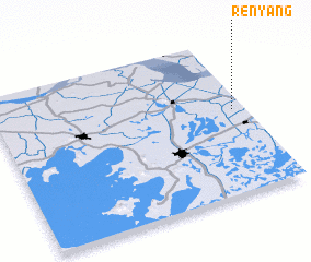 Places with similar names to Renyang, China ::
Disclaimer :: Information on this page comes without warranty of any kind |
||
|
Where is Renyang? Elevation and coordinates ::
Latitude (lat): 31°32'14"N Longitude (lon): 120°57'1"E
Elevation (approx.): 2m (map arrows pan, magnifying glasses zoom) |
||
|
Visiting Renyang? Hotel/Accommodation ::
Book a hotel in Renyang Travel Guide ::
Buy a travel guide for China rental cars ::
car rental offers GPS waypoint ::
download a GPX waypoint (PoI) of Renyang for your GPS receiver
|
||