|
search place name
|
||
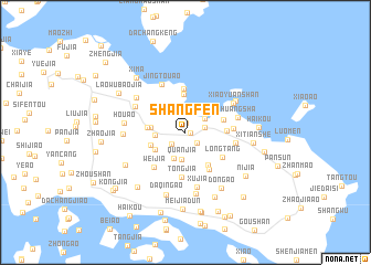
Shangfen (Zhejiang, China)Shangfen is a town in the Zhejiang region of China. An overview map of the region around Shangfen is displayed below.
regional and 3d topo map of Shangfen, China ::
Shangfen airports ::
The nearest airport is NGB - Ninbo Lishe, located 74.4 km west of Shangfen.
Other airports nearby include SHA - Shanghai Hongqiao Intl (149.4 km north west), HGH - Hangzhou Xiaoshan (169.4 km west), Nearby towns ::
Shuiguankou (0.4km east) //
Shagenli (1.0km north) //
Aodichen (1.5km south east) //
Donghu (1.7km south west) //
Fangjia (1.8km east) //
Mazhi (2.2km north east) //
Quanjia (2.8km south) //
Chaomian (2.8km south) //
Nanshanxia (2.6km west) //
Xiaohemei (3.0km north west) //
Baiquanzhen (3.1km west) //
Gaochi (3.2km south west) //
Shujia (3.3km south west) //
Tangjia'ao (3.8km north) //
Shizilu (3.4km west) //
Gaoxie (3.9km south east) //
Hejia (3.6km east) //
Beichan (3.6km east) //
Yangjia (4.2km south east) //
Langxi (4.4km north) //
Longtang (4.1km south east) //
Tongjia (4.6km south) //
Weijia (4.5km south west) //
Hongjia (4.2km east) //
Xiaozhan (4.5km east) //
Jingtouʼao (5.2km north west) //
Huangsha (4.8km east) //
Xujia (5.6km south) //
Lixinwu (5.1km north west) //
[all distances 'as the bird flies' and approximate] 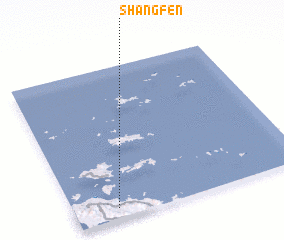 Places with similar names to Shangfen, China ::
// Shang-fan (TW)
// Chợ Ông Văn (VN)
// Changfan (CN)
// Changfen (CN)
// Shankevani (GE)
// Shangfan (CN)
// Shangfan (CN)
Disclaimer :: Information on this page comes without warranty of any kind |
||
|
Where is Shangfen? Elevation and coordinates ::
Latitude (lat): 30°3'58"N Longitude (lon): 122°10'56"E
Elevation (approx.): 27m (map arrows pan, magnifying glasses zoom) |
||
|
Visiting Shangfen? Hotel/Accommodation ::
Book a hotel in Shangfen Travel Guide ::
Buy a travel guide for China rental cars ::
car rental offers GPS waypoint ::
download a GPX waypoint (PoI) of Shangfen for your GPS receiver
|
||