|
search place name
|
||
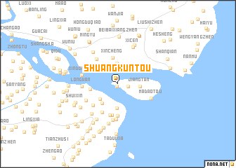
Shuangkuntou (Zhejiang, China)Shuangkuntou is a town in the Zhejiang region of China. An overview map of the region around Shuangkuntou is displayed below.
regional and 3d topo map of Shuangkuntou, China ::
Shuangkuntou airports ::
The nearest airport is MZW - Matsu Beigan, located 211.0 km south west of Shuangkuntou.
Other airports nearby include NGB - Ninbo Lishe (214.2 km north), Nearby towns ::
Dankunshanxia (0.5km south west) //
Lingkun (1.5km east) //
Cangxia (3.3km north) //
Jiangtan (3.1km east) //
Houchen (3.5km south west) //
Xiaodoumen (3.8km south) //
Shanbei (3.9km south west) //
Panshizhen (3.8km north west) //
Xincheng (4.2km north) //
Xincheng (4.2km north) //
Longdong (4.0km west) //
Beidang (5.0km south) //
Ningcheng (5.1km south) //
Ningcunso (5.1km south) //
Wuliyan (4.9km south west) //
Zhongshi (5.0km north west) //
Doumen (5.1km south west) //
Nandang (5.7km south) //
Zhuqiao (5.2km south west) //
Longwan (5.1km west) //
Madaotou (5.2km south east) //
Sicun (5.8km south) //
Xindoumen (5.3km west) //
Shangjing (6.0km south west) //
Xicen (6.2km north) //
Shachan (6.4km south) //
Ruili (6.2km north west) //
Yongzhongzhen (6.4km south west) //
Sanshan (6.6km north) //
[all distances 'as the bird flies' and approximate] 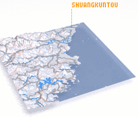 Places with similar names to Shuangkuntou, China ::
Disclaimer :: Information on this page comes without warranty of any kind |
||
|
Where is Shuangkuntou? Elevation and coordinates ::
Latitude (lat): 27°58'14"N Longitude (lon): 120°51'7"E
Elevation (approx.): 1m (map arrows pan, magnifying glasses zoom) |
||
|
Visiting Shuangkuntou? Hotel/Accommodation ::
Book a hotel in Shuangkuntou Travel Guide ::
Buy a travel guide for China rental cars ::
car rental offers GPS waypoint ::
download a GPX waypoint (PoI) of Shuangkuntou for your GPS receiver
|
||