|
search place name
|
||
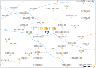
Tangting (Anhui, China)Tangting is a town in the Anhui region of China. An overview map of the region around Tangting is displayed below.
regional and 3d topo map of Tangting, China ::
Tangting airports ::
The nearest airport is HFE - Hefei Luogang, located 210.3 km south of Tangting.
Nearby towns ::
Niupaifang (3.2km north east) //
Qianwalijia (3.6km south west) //
Liji (4.2km south west) //
Hancun (4.4km north west) //
Zhoudazhuang (4.6km east) //
Liluoxu (5.0km west) //
Wangxuzi (5.0km east) //
Chenlou (5.4km north east) //
Darenjia (6.4km south west) //
Guoji (6.7km south) //
Xiaohu (6.2km west) //
Gaoqiao (7.2km south east) //
Wugou (8.6km south west) //
Qiluzhoujia (8.3km north west) //
Tiansizhuang (9.5km south east) //
Dalijia (10.4km south west) //
[all distances 'as the bird flies' and approximate]  Places with similar names to Tangting, China ::
// Daungdong (PH)
// Tangtong (MM)
// Tangtong (MM)
// Tangtung (MM)
// Taungdaung (MM)
// Tankotenga (BF)
// Tongotongo (CD)
// Dingdinga (IN)
// Tangatanga (ID)
// Dong Dang (MY)
Disclaimer :: Information on this page comes without warranty of any kind |
||
|
Where is Tangting? Elevation and coordinates ::
Latitude (lat): 33°36'0"N Longitude (lon): 116°40'0"E
Elevation (approx.): 30m (map arrows pan, magnifying glasses zoom) |
||
|
Visiting Tangting? Hotel/Accommodation ::
Book a hotel in Tangting Travel Guide ::
Buy a travel guide for China rental cars ::
car rental offers GPS waypoint ::
download a GPX waypoint (PoI) of Tangting for your GPS receiver
|
||