|
search place name
|
||
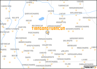
Tiangongyuancun (Beijing, China)Tiangongyuancun is a town in the Beijing region of China. An overview map of the region around Tiangongyuancun is displayed below.
regional and 3d topo map of Tiangongyuancun, China ::
Tiangongyuancun airports ::
The nearest airport is PEK - Beijing Capital Intl, located 53.0 km north east of Tiangongyuancun.
Other airports nearby include TSN - Tianjin Binhai (105.8 km south east), Nearby towns ::
Panggezhuang (2.8km south) //
Weizhuang (2.7km north west) //
Langgezhuang (2.8km north east) //
Beizangcun (4.2km north west) //
Xiejiaying (5.0km south) //
Pigezhuang (4.5km west) //
Houdaying (5.4km north east) //
Xiaoying (7.2km south) //
Guicun (6.7km north east) //
Dingfuzhuang (6.9km south west) //
Beiyanfa (6.1km east) //
Dalangfa (6.6km south east) //
Huangcun (8.2km north) //
Daxing (8.2km north) //
Xiheifa (8.1km south) //
Macun (7.4km north west) //
Liucun (8.3km north east) //
Yaoshitou (9.1km south) //
Qianxinzhuang (8.7km north west) //
Jialufa (8.8km south east) //
Zhugeying (9.4km south west) //
[all distances 'as the bird flies' and approximate]  Places with similar names to Tiangongyuancun, China :: Disclaimer :: Information on this page comes without warranty of any kind |
||
|
Where is Tiangongyuancun? Elevation and coordinates ::
Latitude (lat): 39°38'53"N Longitude (lon): 116°19'13"E
Elevation (approx.): 37m (map arrows pan, magnifying glasses zoom) |
||
|
Visiting Tiangongyuancun? Hotel/Accommodation ::
Book a hotel in Tiangongyuancun Travel Guide ::
Buy a travel guide for China rental cars ::
car rental offers GPS waypoint ::
download a GPX waypoint (PoI) of Tiangongyuancun for your GPS receiver
|
||