|
search place name
|
||
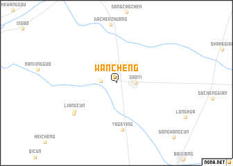
Wancheng (Hebei, China)Wancheng is a town in the Hebei region of China. An overview map of the region around Wancheng is displayed below.
regional and 3d topo map of Wancheng, China ::
Wancheng airports ::
The nearest airport is TYN - Taiyuan Wusu, located 173.2 km west of Wancheng.
Nearby towns ::
Wangtongzhuang (2.0km west) //
Gaoyi (2.4km east) //
Yageying (7.5km south) //
Liangcun (7.0km south west) //
Xifucun (7.4km south west) //
[all distances 'as the bird flies' and approximate] 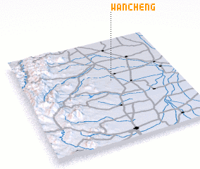 Places with similar names to Wancheng, China ::
// Wŏnch'ang (KP)
// Wŏnch'ang (KP)
// Wenchangge (CN)
// Wān Chu-ang (MM)
// Wān Niu-chang (MM)
// Wawnchhung Ga (MM)
// Wunchaung (MM)
// Wanchang (CN)
// Wancheng (CN)
// Wancheng (CN)
Disclaimer :: Information on this page comes without warranty of any kind |
||
|
Where is Wancheng? Elevation and coordinates ::
Latitude (lat): 37°36'0"N Longitude (lon): 114°35'0"E
Elevation (approx.): 56m (map arrows pan, magnifying glasses zoom) |
||
|
Visiting Wancheng? Hotel/Accommodation ::
Book a hotel in Wancheng Travel Guide ::
Buy a travel guide for China rental cars ::
car rental offers GPS waypoint ::
download a GPX waypoint (PoI) of Wancheng for your GPS receiver
|
||