|
search place name
|
||
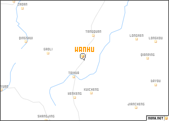
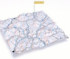
Wanhu (Fujian, China)Wanhu is a town in the Fujian region of China. An overview map of the region around Wanhu is displayed below.
regional and 3d topo map of Wanhu, China ::
Wanhu airports ::
The nearest airport is XMN - Xiamen Gaoqi, located 149.5 km south of Wanhu.
Other airports nearby include KNH - Chinmen Shang Yi (169.1 km south), FOC - Fuzhou Changle (193.0 km east), Nearby towns ::
 Places with similar names to Wanhu, China ::
// Waniho (NG)
// Wŏnha (KP)
// Wanahaua (PG)
// Wān Hai-oi (MM)
// Wān Nā-hi (MM)
// Wan-hua (TW)
// Wān Hoi (MM)
// Wān Na-hai (MM)
// Wān Na-hi (MM)
// Wān Ha (MM)
Disclaimer :: Information on this page comes without warranty of any kind |
||
|
Where is Wanhu? Elevation and coordinates ::
Latitude (lat): 25°50'47"N Longitude (lon): 117°44'25"E
Elevation (approx.): 621m (map arrows pan, magnifying glasses zoom) |
||
|
Visiting Wanhu? Hotel/Accommodation ::
Book a hotel in Wanhu Travel Guide ::
Buy a travel guide for China rental cars ::
car rental offers GPS waypoint ::
download a GPX waypoint (PoI) of Wanhu for your GPS receiver
|
||