|
search place name
|
||
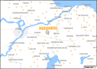
Wuduwang (Zhejiang, China)Wuduwang is a town in the Zhejiang region of China. An overview map of the region around Wuduwang is displayed below.
regional and 3d topo map of Wuduwang, China ::
Wuduwang airports ::
The nearest airport is NGB - Ninbo Lishe, located 18.2 km west of Wuduwang.
Other airports nearby include HGH - Hangzhou Xiaoshan (123.5 km west), SHA - Shanghai Hongqiao Intl (150.6 km north), Nearby towns ::
Xiangjia (1.4km south east) //
Jianglong (1.8km north) //
Shangwang (2.4km north east) //
Qiu'ai (2.4km south west) //
Yanjia (2.9km east) //
Zhongjiaqiao (3.5km north east) //
Fuming (3.5km west) //
Meixu (4.1km north) //
Dacao (4.2km north west) //
Xiadu'ao (4.5km north east) //
Wuxiangqi (4.3km south east) //
Gaotangtou (4.9km south) //
Zhongjiasha (5.0km south east) //
Wangjiagang (5.4km north east) //
Yejia (5.8km north west) //
Yangjia (6.6km north) //
Yinjiageng (5.9km west) //
Shiqiao (6.5km north east) //
Gaoqian (6.9km south) //
Houwugang (6.8km south west) //
Xianmeihunongchang (7.0km south east) //
Aoyu (7.2km north east) //
Yaoshu'ao (6.8km east) //
Panhuo (7.0km south west) //
Beijiao (7.2km north west) //
Zhuangshi (7.8km north west) //
Tangjia (8.2km north) //
Tangjiawan (7.6km south east) //
Baojia (8.5km north) //
[all distances 'as the bird flies' and approximate]  Places with similar names to Wuduwang, China ::
// Wetwang (GB)
Disclaimer :: Information on this page comes without warranty of any kind |
||
|
Where is Wuduwang? Elevation and coordinates ::
Latitude (lat): 29°51'56"N Longitude (lon): 121°38'42"E
Elevation (approx.): 6m (map arrows pan, magnifying glasses zoom) |
||
|
Visiting Wuduwang? Hotel/Accommodation ::
Book a hotel in Wuduwang Travel Guide ::
Buy a travel guide for China rental cars ::
car rental offers GPS waypoint ::
download a GPX waypoint (PoI) of Wuduwang for your GPS receiver
|
||