|
search place name
|
||
Xiaxintang (Zhejiang, China)Xiaxintang is a town in the Zhejiang region of China. An overview map of the region around Xiaxintang is displayed below.
regional and 3d topo map of Xiaxintang, China ::

Xiaxintang airports ::
The nearest airport is NGB - Ninbo Lishe, located 44.5 km south of Xiaxintang.
Other airports nearby include HGH - Hangzhou Xiaoshan (83.9 km west), SHA - Shanghai Hongqiao Intl (110.2 km north), Nearby towns ::
Xiashe (1.4km north east) //
Luojiazhuang (1.6km south) //
Yuantang (1.7km south) //
Songding (1.7km east) //
Shengshan (2.5km north) //
Zebu (2.9km south) //
Xiaolutou (3.0km south east) //
Houfangding (2.9km north east) //
Xiaolinzhen (3.2km south east) //
Qingxinting (3.1km north west) //
Hejiao (3.2km south west) //
Hengxintang (3.6km south) //
Shengdong (3.5km north east) //
Datangtou (4.8km south) //
Luojialutou (4.8km north) //
Zhangshu (5.0km south) //
Chengjia (5.0km north) //
Shengxi (5.1km north) //
Xiaotangtou (5.1km south east) //
Tanheyan (5.0km south east) //
Sanguan (5.1km south east) //
Baishazhen (5.4km south west) //
Hengqiaotou (5.4km north east) //
Kuangyan (5.8km south) //
Zhangshu (6.0km south) //
Kandun (5.5km north west) //
Shengbei (6.0km north east) //
Xinpuyan (6.1km north east) //
Xujiata (6.5km south west) //
[all distances 'as the bird flies' and approximate] 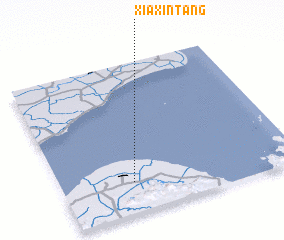 Places with similar names to Xiaxintang, China ::
// Soksin-dong (KP)
// Sŏksan-dong (KP)
Disclaimer :: Information on this page comes without warranty of any kind |
||
|
Where is Xiaxintang? Elevation and coordinates ::
Latitude (lat): 30°12'15"N Longitude (lon): 121°18'21"E
Elevation (approx.): 6m (map arrows pan, magnifying glasses zoom) |
||
|
Visiting Xiaxintang? Hotel/Accommodation ::
Book a hotel in Xiaxintang Travel Guide ::
Buy a travel guide for China rental cars ::
car rental offers GPS waypoint ::
download a GPX waypoint (PoI) of Xiaxintang for your GPS receiver
|
||