|
search place name
|
||
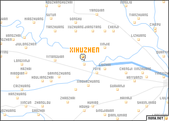
Xihuzhen (Anhui, China)Xihuzhen is a town in the Anhui region of China. An overview map of the region around Xihuzhen is displayed below.
regional and 3d topo map of Xihuzhen, China ::
Xihuzhen airports ::
The nearest airport is HFE - Hefei Luogang, located 202.9 km south east of Xihuzhen.
Other airports nearby include CGO - Zhengzhou Xinzheng (241.3 km north west), Nearby towns ::
Datian (0.9km south) //
Yuye (3.6km south east) //
Liuzhai (4.3km south east) //
Xinjie (4.8km north east) //
Xiaowazhuang (5.6km south) //
Yitangdian (5.4km west) //
Damingzhuang (6.0km south west) //
Xuzhuang (6.7km north) //
Jiangtang (6.7km north) //
Dongjiazhuang (6.7km south) //
Caozhai (7.6km north east) //
Donghu (8.5km north) //
Tianpengji (7.8km south west) //
Tanzhuang (8.5km north west) //
Chenji (8.5km north east) //
Guawanji (9.0km south east) //
[all distances 'as the bird flies' and approximate]  Places with similar names to Xihuzhen, China ::
// Zhizhino (RU)
// Zhu'aozhen (CN)
// Zhozhoni (GE)
// Zhozhoni (GE)
// Sihezhen (CN)
// Xiaohezhen (CN)
// Xiaohezhen (CN)
// Xiehezhen (CN)
// Xihuazhen (CN)
// Zhaizhen (CN)
Disclaimer :: Information on this page comes without warranty of any kind |
||
|
Where is Xihuzhen? Elevation and coordinates ::
Latitude (lat): 32°56'30"N Longitude (lon): 115°38'0"E
Elevation (approx.): 33m (map arrows pan, magnifying glasses zoom) |
||
|
Visiting Xihuzhen? Hotel/Accommodation ::
Book a hotel in Xihuzhen Travel Guide ::
Buy a travel guide for China rental cars ::
car rental offers GPS waypoint ::
download a GPX waypoint (PoI) of Xihuzhen for your GPS receiver
|
||