|
search place name
|
||
Yandang (Zhejiang, China)Yandang is a town in the Zhejiang region of China. An overview map of the region around Yandang is displayed below.
regional and 3d topo map of Yandang, China ::

Yandang airports ::
The nearest airport is NGB - Ninbo Lishe, located 189.3 km north of Yandang.
Other airports nearby include MZW - Matsu Beigan (236.1 km south west), Nearby towns ::
Zhang'ao (2.5km north west) //
Qianyang (3.3km north) //
Shibaga (3.4km south) //
Houyang (3.9km north) //
Sidu (4.0km north) //
Longshantou (3.9km south east) //
Lizhang (4.5km south west) //
Chen'ao (4.6km north east) //
Chengbei (4.6km south west) //
Houyu (4.7km east) //
Ding'ao (5.6km north) //
Xilian (5.0km east) //
Yueqing (5.9km south) //
Maniao (5.2km west) //
Xilin (5.9km north east) //
Xiaxue (5.6km north east) //
Guanyinyan (6.2km south west) //
Baisha (6.1km south east) //
Housuo (6.8km south) //
Zhuyu (6.2km east) //
Hubian (6.7km north east) //
Danxi (6.9km north east) //
Shenhai (6.8km south east) //
Xiatang (6.8km south east) //
Heqi (6.7km north east) //
Batou (7.3km south east) //
Nan'ao (7.1km south west) //
Hushang'ao (7.9km south) //
Panjiayang (8.0km south) //
[all distances 'as the bird flies' and approximate] 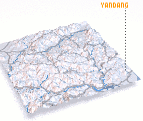 Places with similar names to Yandang, China ::
Disclaimer :: Information on this page comes without warranty of any kind |
||
|
Where is Yandang? Elevation and coordinates ::
Latitude (lat): 28°10'47"N Longitude (lon): 120°56'57"E
Elevation (approx.): 332m (map arrows pan, magnifying glasses zoom) |
||
|
Visiting Yandang? Hotel/Accommodation ::
Book a hotel in Yandang Travel Guide ::
Buy a travel guide for China rental cars ::
car rental offers GPS waypoint ::
download a GPX waypoint (PoI) of Yandang for your GPS receiver
|
||