|
search place name
|
||
Zhentou (Zhejiang, China)Zhentou is a town in the Zhejiang region of China. An overview map of the region around Zhentou is displayed below.
regional and 3d topo map of Zhentou, China ::

Zhentou airports ::
The nearest airport is NGB - Ninbo Lishe, located 157.7 km north east of Zhentou.
Other airports nearby include HGH - Hangzhou Xiaoshan (165.9 km north), Nearby towns ::
Canglingkeng (2.1km north west) //
Baolong (3.2km south west) //
Dalin (3.6km south east) //
Hengxi (4.5km east) //
Shanghu (5.7km south) //
Zhengqiao (5.3km north east) //
Yang'an (5.4km south west) //
Xitou (6.8km east) //
Potan (7.3km east) //
Nantian (7.9km north west) //
Fangzhai (8.3km south west) //
Waitaxi (9.0km south) //
[all distances 'as the bird flies' and approximate] 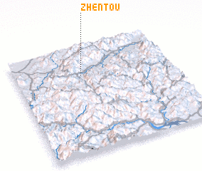 Places with similar names to Zhentou, China ::
Disclaimer :: Information on this page comes without warranty of any kind |
||
|
Where is Zhentou? Elevation and coordinates ::
Latitude (lat): 28°43'58"N Longitude (lon): 120°25'29"E
Elevation (approx.): 163m (map arrows pan, magnifying glasses zoom) |
||
|
Visiting Zhentou? Hotel/Accommodation ::
Book a hotel in Zhentou Travel Guide ::
Buy a travel guide for China rental cars ::
car rental offers GPS waypoint ::
download a GPX waypoint (PoI) of Zhentou for your GPS receiver
|
||