|
search place name
|
||
Adh Dhirā‘ (‘Adan, Yemen)Adh Dhirā‘ is a town in the ‘Adan region of Yemen. An overview map of the region around Adh Dhirā‘ is displayed below.
regional and 3d topo map of Adh Dhirā‘, Yemen ::
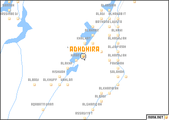
Nearby towns ::
‘Ubayyah (1.9km north) //
Ghanīyah (1.8km west) //
Ḩimān (1.8km west) //
Jahrabah (2.6km north west) //
Khalwāt (3.7km north) //
Al Khulfān (4.0km north east) //
Jālis (4.1km north east) //
Al Akhf (4.0km south west) //
Ghabar (5.4km east) //
Al Aḩmar (5.8km north) //
Māliḩ (5.8km north) //
Mawqiş (5.8km north) //
As Salīl (5.8km north) //
Mishwah (6.5km south west) //
Waḩlān (6.6km south west) //
Ar Rawḑah (7.2km east) //
Al Ḩarajah (7.2km east) //
Al Fāri‘ (7.4km east) //
Fawshah (7.4km east) //
Al Jidfirah (7.4km east) //
Al Jashūʼ (7.4km east) //
Al Jābih (7.6km north) //
Gebarah (7.7km north east) //
Ḩişn Nāşir (7.7km south west) //
Dhummar (8.1km south east) //
Salahah (8.1km south east) //
Ḩabbān (8.1km south east) //
Al Jawharah as Suflá (8.2km south east) //
Al Jawharah al ‘Ulyā (8.2km south east) //
[all distances 'as the bird flies' and approximate] 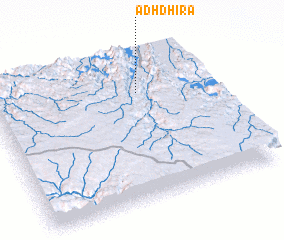 Places with similar names to Adh Dhirā‘, Yemen ::
Disclaimer :: Information on this page comes without warranty of any kind |
||
|
Where is Adh Dhirā‘? Elevation and coordinates ::
Latitude (lat): 14°44'0"N Longitude (lon): 45°40'0"E
Elevation (approx.): 1411m (map arrows pan, magnifying glasses zoom) |
||
|
Visiting Adh Dhirā‘? Hotel/Accommodation ::
Book a hotel in Adh Dhirā‘ Travel Guide ::
Buy a travel guide for Yemen rental cars ::
car rental offers GPS waypoint ::
download a GPX waypoint (PoI) of Adh Dhirā‘ for your GPS receiver
|
||