|
search place name
|
||
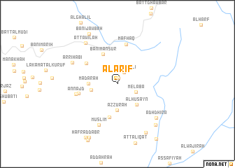
Al ‘Arīf (Yemen)Al ‘Arīf is a town in Yemen. An overview map of the region around Al ‘Arīf is displayed below.
regional and 3d topo map of Al ‘Arīf, Yemen ::
Al ‘Arīf airports ::
The nearest airport is GIZ - Gizan King Abdullah Bin Abdulaziz, located 248.4 km north west of Al ‘Arīf.
Nearby towns ::
Banī Shaddād (0.9km north) //
Bayt al ‘Alī (2.1km north east) //
Melaba (3.1km south east) //
Az̧ Z̧urah (4.2km south) //
Bayt Jurayd (4.1km west) //
Al Ḩuşayn (4.5km south east) //
Madārah (4.5km west) //
Banī Manşūr (5.3km north west) //
Ḑā‘inah (5.4km south) //
Ad Dāʼir (5.8km north west) //
Sūq as Sabt (6.1km west) //
Mafḩaq (6.5km north) //
An Najd (6.6km west) //
Muslim (7.2km south west) //
Ar Riḩābī (7.8km north west) //
Adh Dhirā‘ (8.0km south east) //
Aţ Ţawīlah (8.2km north west) //
Bayt al Bur‘awţ (8.8km south east) //
Bayt Qar‘ad (8.9km south east) //
Banī Jawbah (9.1km north west) //
At Taraḩib (9.6km south west) //
Ḩafr aḑ Ḑabr (9.8km south west) //
Al Ḩamrā (10.6km south east) //
[all distances 'as the bird flies' and approximate] 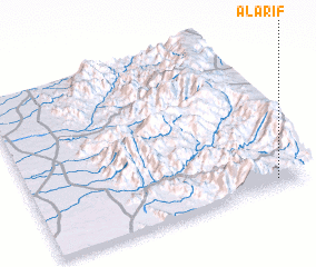 Places with similar names to Al ‘Arīf, Yemen ::
Disclaimer :: Information on this page comes without warranty of any kind |
||
|
Where is Al ‘Arīf? Elevation and coordinates ::
Latitude (lat): 15°2'41"N Longitude (lon): 43°53'25"E
Elevation (approx.): 1673m (map arrows pan, magnifying glasses zoom) |
||
|
Visiting Al ‘Arīf? Hotel/Accommodation ::
Book a hotel in Al ‘Arīf Travel Guide ::
Buy a travel guide for Yemen rental cars ::
car rental offers GPS waypoint ::
download a GPX waypoint (PoI) of Al ‘Arīf for your GPS receiver
|
||