|
search place name
|
||
Al Ghayl (‘Adan, Yemen)Al Ghayl is a town in the ‘Adan region of Yemen. An overview map of the region around Al Ghayl is displayed below.
regional and 3d topo map of Al Ghayl, Yemen ::
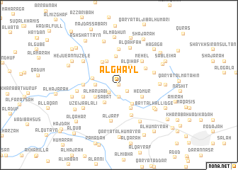
Nearby towns ::
Geolane (NaNkm north) //
Qaryat al Marāgh (1.6km south east) //
Qaryat al Miliḩah (1.8km north) //
As Salāmah (1.9km south) //
Al Ḩurūf (1.9km south west) //
‘Ufaysh (2.6km north west) //
Al Qihāf (3.4km north east) //
Sabāt (3.5km south west) //
Al Afzār (3.6km south east) //
Al Khadie (3.6km west) //
Al Maruabi (4.1km south west) //
AL Laşbah (4.1km north west) //
Al Ḩaymatayn (4.1km south east) //
Hedmur (4.1km south east) //
Qaryat al Ḩaḑan (4.2km west) //
Mudaykhah (4.3km north west) //
Al Madāḩīyah (4.5km north) //
Al Muḩus (4.9km north east) //
Méhel (5.2km north east) //
Maqrabah (5.2km south) //
Gumana (5.4km west) //
Al Maḩsūs (5.6km north) //
Al Kuten (5.7km west) //
Ar Radai (5.7km east) //
Al Jarf (5.9km south) //
Al Qaḩfah (6.1km north) //
Shi‘b Ayūb (6.3km east) //
Shaykh ‘Īsá (6.6km north west) //
Uzeija al Ali (6.6km south west) //
[all distances 'as the bird flies' and approximate] 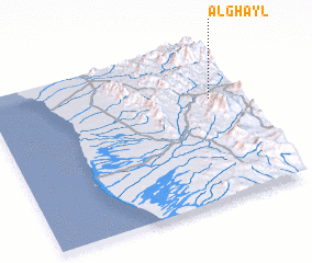 Places with similar names to Al Ghayl, Yemen ::
Disclaimer :: Information on this page comes without warranty of any kind |
||
|
Where is Al Ghayl? Elevation and coordinates ::
Latitude (lat): 13°39'0"N Longitude (lon): 43°54'0"E
Elevation (approx.): 1090m (map arrows pan, magnifying glasses zoom) |
||
|
Visiting Al Ghayl? Hotel/Accommodation ::
Book a hotel in Al Ghayl Travel Guide ::
Buy a travel guide for Yemen rental cars ::
car rental offers GPS waypoint ::
download a GPX waypoint (PoI) of Al Ghayl for your GPS receiver
|
||