|
search place name
|
||
Al Ḩāwirī (Yemen)Al Ḩāwirī is a town in Yemen. An overview map of the region around Al Ḩāwirī is displayed below.
regional and 3d topo map of Al Ḩāwirī, Yemen ::

Al Ḩāwirī airports ::
The nearest airport is GIZ - Gizan King Abdullah Bin Abdulaziz, located 225.2 km north west of Al Ḩāwirī.
Nearby towns ::
Bayt al Ḩāwirī (1.4km east) //
Al Ma‘mar (2.5km west) //
Madām (3.5km south) //
Bayt adh Dhafīf (4.2km north west) //
Bayt al Ḩaqr (4.3km north east) //
Bayt an Na‘ām (4.8km north west) //
Bayt al Ḩamrāʼ (5.1km north west) //
Qaryat al ‘Urrah as Suflá (5.4km south east) //
Kabār (5.5km west) //
Al ‘Irrah (5.8km south east) //
Ţūz̧ān (6.0km south west) //
Ḑirwān (6.3km north west) //
‘Almān (6.6km south) //
Banī Sab‘ah (7.2km north) //
Bayt az Zafīq (7.2km north) //
Al Jāhilīyah (7.1km east) //
Qaryat al Qābil (8.1km south) //
Jidr al A‘lá (8.0km south east) //
Jidr al Asfal (8.0km south east) //
Thuqbān (8.0km south east) //
Jadar (8.1km south east) //
Z̧arwān (8.4km north west) //
Al Hanājir (8.8km south west) //
Jirbān (10.0km north west) //
Ḩarrān (11.3km north west) //
[all distances 'as the bird flies' and approximate] 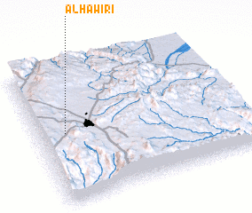 Places with similar names to Al Ḩāwirī, Yemen ::
// Al Huwayr (IQ)
// Al Ḩuwayrah (SA)
// Al Ḩuwayr (SY)
// Al Ḩuwīr (OM)
// Al Ḩuwayrah (YE)
// Al Ḩawar (YE)
Disclaimer :: Information on this page comes without warranty of any kind |
||
|
Where is Al Ḩāwirī? Elevation and coordinates ::
Latitude (lat): 15°31'15"N Longitude (lon): 44°8'0"E
Elevation (approx.): 2255m (map arrows pan, magnifying glasses zoom) |
||
|
Visiting Al Ḩāwirī? Hotel/Accommodation ::
Book a hotel in Al Ḩāwirī Travel Guide ::
Buy a travel guide for Yemen rental cars ::
car rental offers GPS waypoint ::
download a GPX waypoint (PoI) of Al Ḩāwirī for your GPS receiver
|
||