|
search place name
|
||
Al Jubayl (‘Adan, Yemen)Al Jubayl is a town in the ‘Adan region of Yemen. An overview map of the region around Al Jubayl is displayed below.
regional and 3d topo map of Al Jubayl, Yemen ::
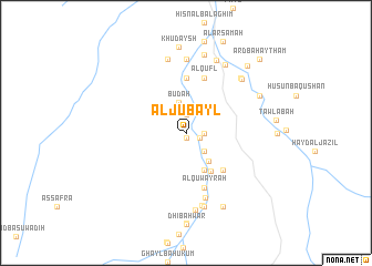
Nearby towns ::
Maţruh (0.5km south) //
Quwayrat al Khazab (1.5km east) //
Az̧ Z̧āhir (1.8km east) //
Ḩişn Bā ‘Abd aş Şamad (1.9km north) //
Khusofar (2.6km south east) //
Jibāb (2.6km south east) //
Al Barshī (2.6km south east) //
Buḑah (3.2km north) //
Ḩadūn (3.6km south east) //
Ḩuwaybah (4.1km south east) //
Ruḩāb (4.5km south east) //
Ḩalbūn (5.2km south east) //
Tamlah (5.6km north) //
Al Quwayrah (5.8km south) //
Al Qufl (5.8km north) //
Al Qurayn (6.7km south) //
Qarn Mājid (7.4km north) //
Ḩawrāʼ (7.4km south) //
Maşna‘at Daw‘an (7.6km south) //
Ḩişn Bā ‘Abbād (7.6km south) //
Bilād al Māʼ (7.6km north) //
Rashīd (7.8km south) //
Subaykh (7.7km north east) //
Al Jadīdah (7.7km north east) //
Şubayrah (7.9km north) //
Jarīf (7.9km north east) //
Tāfilah (8.1km north) //
Ash Shiqq ash Sharqī (8.2km south east) //
Al Mishqa‘ah (8.1km north east) //
[all distances 'as the bird flies' and approximate] 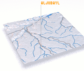 Places with similar names to Al Jubayl, Yemen ::
// Al Jabalāw (EG)
// Al Jubayl (SA)
// Al Jubayl (SA)
// Al Jubaylah (SA)
// Al Jubayl (QA)
// Al Jibāl (OM)
// Al Jubayl (YE)
// Al Jabīl (YE)
// Al Jiblah (YE)
Disclaimer :: Information on this page comes without warranty of any kind |
||
|
Where is Al Jubayl? Elevation and coordinates ::
Latitude (lat): 15°11'0"N Longitude (lon): 48°19'0"E
Elevation (approx.): 1115m (map arrows pan, magnifying glasses zoom) |
||
|
Visiting Al Jubayl? Hotel/Accommodation ::
Book a hotel in Al Jubayl Travel Guide ::
Buy a travel guide for Yemen rental cars ::
car rental offers GPS waypoint ::
download a GPX waypoint (PoI) of Al Jubayl for your GPS receiver
|
||