|
search place name
|
||
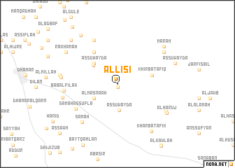
Al Lisī (Yemen)Al Lisī is a town in Yemen. An overview map of the region around Al Lisī is displayed below.
regional and 3d topo map of Al Lisī, Yemen ::
Nearby towns ::
Bayt ad Daylamī (0.5km south) //
As Suwaydā‘ (4.1km south) //
Al Maşna‘ah (4.3km south west) //
Al ‘Allānah (4.8km north west) //
As Suwaydāʼ (4.8km north west) //
Khirbat Afīq (5.6km east) //
Ḩammām al Lassī (6.2km north west) //
Sāmah as Suflá (7.6km south west) //
An Nirb Ghiraa (7.8km north west) //
Sāmah (8.2km south west) //
Bāb al Filāk (8.3km west) //
Al Harūj (8.7km south east) //
Waraka (8.8km north east) //
Dhī Ḩawlān (8.8km west) //
Al Harūj (8.9km south east) //
Kharbat Afīk (9.1km south east) //
Marām (9.4km north east) //
Rakhamah (9.4km north west) //
Shawkān (9.6km north west) //
Abassir (10.0km north west) //
[all distances 'as the bird flies' and approximate]  Places with similar names to Al Lisī, Yemen ::
Disclaimer :: Information on this page comes without warranty of any kind |
||
|
Where is Al Lisī? Elevation and coordinates ::
Latitude (lat): 14°32'15"N Longitude (lon): 44°32'0"E
Elevation (approx.): 2569m (map arrows pan, magnifying glasses zoom) |
||
|
Visiting Al Lisī? Hotel/Accommodation ::
Book a hotel in Al Lisī Travel Guide ::
Buy a travel guide for Yemen rental cars ::
car rental offers GPS waypoint ::
download a GPX waypoint (PoI) of Al Lisī for your GPS receiver
|
||