|
search place name
|
||
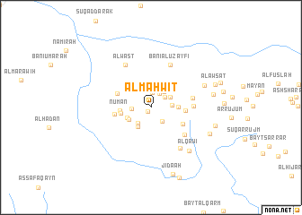
Al Maḩwīt (Muḩāfaz̧at al Maḩwīt, Yemen)Al Maḩwīt is a town in the Muḩāfaz̧at al Maḩwīt region of Yemen. An overview map of the region around Al Maḩwīt is displayed below.
regional and 3d topo map of Al Maḩwīt, Yemen ::
Al Maḩwīt airports ::
The nearest airport is GIZ - Gizan King Abdullah Bin Abdulaziz, located 188.7 km north west of Al Maḩwīt.
Nearby towns ::
Az̧ Z̧ubr (0.6km south west) //
Masjid al ‘Urr (1.8km north) //
Bayt Muray‘ (2.0km north east) //
Bayt Sanad (2.1km north east) //
Hijrat Dawā‘ir (2.2km south east) //
Bayt al Khayyāţī (2.3km west) //
Bayt an Najjār (2.5km north east) //
Al Hijran (2.6km south west) //
Bayt Iskandar (2.6km east) //
Bayt an Nawwār (2.7km north east) //
‘Anbar (2.9km south west) //
Sabal (3.0km south west) //
Bayt Turkī (3.1km south west) //
Banī aţ Ţayyār (3.2km east) //
Ar Rayādī (3.7km north west) //
Al Mu‘āyinah (3.7km west) //
Nu‘mān (3.8km west) //
Bayt al Ward (4.2km east) //
Al Utākah (4.4km south east) //
Al Qana‘ah (4.3km north west) //
Al Qurūn (4.4km west) //
Bayt al Bishārī (5.1km east) //
Ma‘nīt (5.2km east) //
Sīd (5.3km south east) //
Banī al ‘Uzayfī (5.7km north east) //
Al Wasţ (6.1km north west) //
Suqāmah (6.1km south east) //
Bayt Sarūm (6.9km north east) //
Al Qaw‘ī (7.1km south east) //
[all distances 'as the bird flies' and approximate] 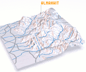 Places with similar names to Al Maḩwīt, Yemen ::
// Al Mawaddah (EG)
Disclaimer :: Information on this page comes without warranty of any kind |
||
|
Where is Al Maḩwīt? Elevation and coordinates ::
Latitude (lat): 15°28'10"N Longitude (lon): 43°32'43"E
Elevation (approx.): 2127m (map arrows pan, magnifying glasses zoom) |
||
|
Visiting Al Maḩwīt? Hotel/Accommodation ::
Book a hotel in Al Maḩwīt Travel Guide ::
Buy a travel guide for Yemen rental cars ::
car rental offers GPS waypoint ::
download a GPX waypoint (PoI) of Al Maḩwīt for your GPS receiver
|
||