|
search place name
|
||
Al Qaflah (‘Adan, Yemen)Al Qaflah is a town in the ‘Adan region of Yemen. An overview map of the region around Al Qaflah is displayed below.
regional and 3d topo map of Al Qaflah, Yemen ::

Nearby towns ::
Habuka (1.9km north) //
Al ‘Adaf (1.9km south) //
‘Atabah (2.6km north west) //
Ghanīyah (3.6km east) //
Şarşarah (3.6km east) //
Dār al Ḩarf (4.1km north west) //
Al Maḩallah (4.1km south east) //
Shajuf (5.8km north) //
Ar Ribāţ (6.6km south east) //
Al Hijirrah (6.6km south east) //
Asif (6.6km south east) //
Al Ma‘bad (6.6km south west) //
Tuwarsah (7.3km south east) //
Ja‘arīr (7.2km east) //
Mawfiţah (7.2km east) //
Atad (7.6km north) //
Şurayşirah (7.4km east) //
Nuwab (7.4km east) //
Shanab (7.6km south) //
Al Qaryah (8.2km north east) //
As Safaf (8.2km north east) //
Al Ḩaql (8.1km north west) //
Al Kubain (8.1km north east) //
Salūl (8.2km south west) //
Al ‘Arīsh (8.1km south east) //
Al Huşan (8.3km south east) //
Al Haifa (9.2km north east) //
Al Ḩayfah (9.2km north east) //
Az̧ Z̧uhayr (9.2km south west) //
[all distances 'as the bird flies' and approximate] 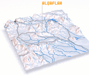 Places with similar names to Al Qaflah, Yemen ::
Disclaimer :: Information on this page comes without warranty of any kind |
||
|
Where is Al Qaflah? Elevation and coordinates ::
Latitude (lat): 13°40'0"N Longitude (lon): 44°30'0"E
Elevation (approx.): 1744m (map arrows pan, magnifying glasses zoom) |
||
|
Visiting Al Qaflah? Hotel/Accommodation ::
Book a hotel in Al Qaflah Travel Guide ::
Buy a travel guide for Yemen rental cars ::
car rental offers GPS waypoint ::
download a GPX waypoint (PoI) of Al Qaflah for your GPS receiver
|
||