|
search place name
|
||
‘Anāq (Ḩaḑramawt, Yemen)‘Anāq is a town in the Ḩaḑramawt region of Yemen. An overview map of the region around ‘Anāq is displayed below.
regional and 3d topo map of ‘Anāq, Yemen ::
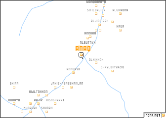
Nearby towns ::
Manḩūb (2.9km north) //
Al Buţayḩ (3.0km north) //
Dakwah (3.0km east) //
Al Himmah (3.0km east) //
An Nu‘ayr (3.8km south west) //
Maşna‘at al Khushūr (4.8km north) //
Ar Riḩib (5.2km north) //
Habab Shamlān (6.9km south) //
Suraywāh (7.1km north east) //
Ghayl Bin Yazīd (7.0km south east) //
Khanfar (7.5km north east) //
‘Amd (7.8km south west) //
Al Jidfirah (8.5km north east) //
Dār Dhirab (8.9km south west) //
Jāḩiz (8.9km south west) //
Qarn al Māl (10.6km north east) //
Ḩaḑā (10.5km north east) //
Habrah (11.4km south west) //
[all distances 'as the bird flies' and approximate] 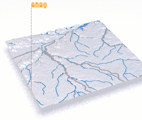 Places with similar names to ‘Anāq, Yemen ::
Disclaimer :: Information on this page comes without warranty of any kind |
||
|
Where is ‘Anāq? Elevation and coordinates ::
Latitude (lat): 15°21'29"N Longitude (lon): 48°1'24"E
Elevation (approx.): 915m (map arrows pan, magnifying glasses zoom) |
||
|
Visiting ‘Anāq? Hotel/Accommodation ::
Book a hotel in ‘Anāq Travel Guide ::
Buy a travel guide for Yemen rental cars ::
car rental offers GPS waypoint ::
download a GPX waypoint (PoI) of ‘Anāq for your GPS receiver
|
||