|
search place name
|
||
As Suqbān (Al Ḩudaydah, Yemen)As Suqbān is a town in the Al Ḩudaydah region of Yemen. An overview map of the region around As Suqbān is displayed below.
regional and 3d topo map of As Suqbān, Yemen ::

As Suqbān airports ::
The nearest airport is GIZ - Gizan King Abdullah Bin Abdulaziz, located 174.1 km north west of As Suqbān.
Nearby towns ::
Al Muḑbār (1.5km south east) //
Al Madāfin (1.6km north east) //
Al Quraş (2.0km west) //
Maḩall Kuwālah (2.3km south) //
Maḩall Fattāḩ (3.3km south) //
Qarnabūr (3.4km north west) //
Dawghān (3.3km west) //
Maḩall al Khubayb (3.6km south west) //
Ḑibyān (4.2km south east) //
Al Kadḩah (4.7km south) //
Dayr ‘Uwīdān (5.0km north west) //
Al Manqaţa‘ (5.9km south west) //
Al Maşlūbah (6.4km south) //
Al Ḩarashah (6.4km south) //
Ḩabīl (6.4km north west) //
Ar Rāyah (6.6km south west) //
Al Khashab (6.6km south west) //
Ar Rāfi‘ī (6.9km south) //
Dayr al Ḩulayl (6.8km west) //
Maḩall al Hulaylī (6.8km west) //
Dayr al ‘Ajūr (7.2km south west) //
Dayr Sawdāʼ (7.4km north east) //
Maḩall ash Shawq (7.3km west) //
Maḩall Aza‘ (7.6km north east) //
Maḩall al Burūq (7.8km south) //
‘Urājah (7.7km south west) //
Maḩall as Suwayd (7.7km west) //
Maḩall al ‘Abbāsah (7.8km west) //
Ash Sharaf (8.0km south west) //
[all distances 'as the bird flies' and approximate] 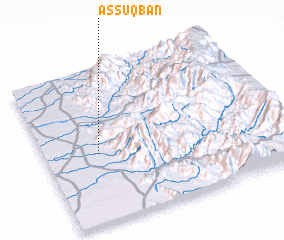 Places with similar names to As Suqbān, Yemen ::
Disclaimer :: Information on this page comes without warranty of any kind |
||
|
Where is As Suqbān? Elevation and coordinates ::
Latitude (lat): 15°27'21"N Longitude (lon): 43°13'47"E
Elevation (approx.): 178m (map arrows pan, magnifying glasses zoom) |
||
|
Visiting As Suqbān? Hotel/Accommodation ::
Book a hotel in As Suqbān Travel Guide ::
Buy a travel guide for Yemen rental cars ::
car rental offers GPS waypoint ::
download a GPX waypoint (PoI) of As Suqbān for your GPS receiver
|
||